Ardmore in Atlanta in Fulton County, Georgia — The American South (South Atlantic)
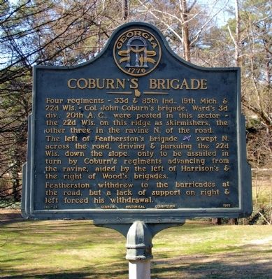
Coburn's Brigade
Four regiments ~ 33d & 85th Ind., 19th Mich. & 22d Wis. ~ Col. John Coburnís brigade, Wardís 3d div., 20th A.C., were posted in this sector ~ the 22d Wis. on the ridge as skirmishers, the other three in the ravine N. of the road.
The left of Featherstonís brigade [CS], swept N. across the road, driving & pursuing the 22d Wis. down the slope, only to be assailed in turn by Coburnís regiments advancing from the ravine, aided by the left of Harrisonís & the right of Woodís brigades.
Featherston withdrew to the barricades at the road, but a lack of support on right & left forced his withdrawal.
Erected 1955 by Georgia Historical Commission. (Marker Number 060-36.)
Topics and series. This historical marker is listed in this topic list: War, US Civil. In addition, it is included in the Georgia Historical Society series list.
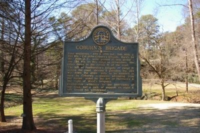
Location. 33° 48.383′ N, 84° 23.942′ W. Marker is in Atlanta, Georgia, in Fulton County. It is in Ardmore. Marker is on Ardmore Road, 0.1 miles south of Collier Road, on the right when traveling south. Marker is now located at Atlanta's Ardmore Park. It was originally located on Collier Road near Ardmore Road, at the railroad bridge. Touch for map. Marker is in this post office area: Atlanta GA 30309, United States of America. Touch for directions.
Other nearby markers. At least 8 other markers are within walking distance of this marker. Wood's Brigade (a few steps from this marker); Featherstonís Brigade (a few steps from this marker); The Mississippi Brigade (approx. 0.2 miles away); Old Montgomery Fy. Rd. (approx. 0.2 miles away); 33d N.J. State Flag (approx. 0.2 miles away); Gap in Federal Line (approx. ľ mile away); Collier's Mill (approx. 0.3 miles away); Harrisonís Brigade (approx. 0.3 miles away). Touch for a list and map of all markers in Atlanta.
Regarding Coburn's Brigade. These movements were part of the Battle of Peachtree Creek, General John Bell Hood's first action after being given command of the Army of Tennessee, replacing General Joseph E. Johnston.
Also see . . . Battle of Peachtree Creek. Wikipedia entry (Submitted on February 19, 2021, by Larry Gertner of New York, New York.)
Credits. This page was last revised on February 8, 2023. It was originally submitted on February 22, 2009, by David Seibert of Sandy Springs, Georgia. This page has been viewed 1,154 times since then and 16 times this year. Photos: 1, 2. submitted on February 22, 2009, by David Seibert of Sandy Springs, Georgia. • Craig Swain was the editor who published this page.

