Buckhead in Atlanta in Fulton County, Georgia — The American South (South Atlantic)
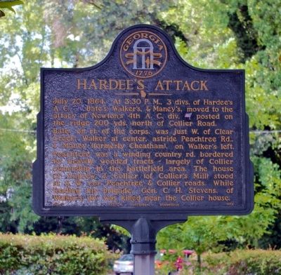
Hardee’s Attack
Bate, on the right of the corps, was just west of Clear Creek; Walker at center, astride Peachtree Rd., & Maney (formerly Cheatham), on Walker’s left. Peachtree was a winding country rd. bordered by heavily wooded tracts—largely of Collier ownership in the battlefield area. The house of Andrew J. Collier (of Collier’s Mill) stood at S. W. cor. Peachtree & Collier roads. While leading his brigade, Gen. C. H. Stevens, of Walker’s div. was killed near the Collier House.
Erected 1956 by Georgia Historical Commission. (Marker Number 060-71.)
Topics and series. This historical marker is listed in this topic list: War, US Civil. In addition, it is included in the Georgia Historical Society series list. A significant historical date for this entry is July 20, 1900.
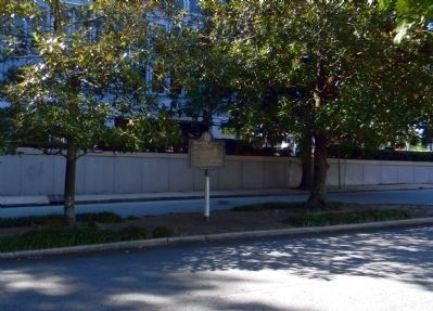
Location. 33° 48.295′ N, 84° 23.579′ W. Marker is in Atlanta, Georgia, in Fulton County. It is in Buckhead. Marker is on Palisades Road NE, 0 miles Peachtree Road NE (U.S. 19), in the median. Touch for map. Marker is in this post office area: Atlanta GA 30309, United States of America. Touch for directions.
Other nearby markers. At least 8 other markers are within walking distance of this marker. Battlefield of Peachtree Creek (within shouting distance of this marker); The Indian Trail Echota (within shouting distance of this marker); Old Montgomery Fy. Rd. (approx. 0.2 miles away); Newton’s Division (approx. Ľ mile away); Hardee at Peachtree Creek (approx. Ľ mile away); Featherston’s Brigade (approx. 0.4 miles away); Coburn's Brigade (approx. 0.4 miles away); Wood's Brigade (approx. 0.4 miles away). Touch for a list and map of all markers in Atlanta.
Credits. This page was last revised on February 8, 2023. It was originally submitted on February 27, 2009, by David Seibert of Sandy Springs, Georgia. This page has been viewed 1,337 times since then and 23 times this year. Photos: 1. submitted on February 27, 2009, by David Seibert of Sandy Springs, Georgia. 2. submitted on October 3, 2011, by PaulwC3 of Northern, Virginia. • Craig Swain was the editor who published this page.

