Near Lawrenceville in Brunswick County, Virginia — The American South (Mid-Atlantic)
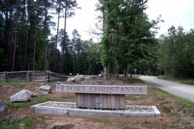
Fort Christanna: Established 1714
“The Farthest Western Outpost of the British Empire”
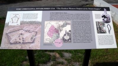
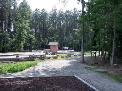
You are standing at the site of Fort Christanna, a colonial fort laid out in 1714 by Virginia’s Governor Alexander Spotswood. The fort was built on a tract of land set aside in 1714 for a trading post, as well as a site for rangers to patrol the area and keep peace, and as a home for the Saponie (the most common spelling at that time) people. Spotswood named the fort “Christ-Anna” for his religion and his queen.
The area that is now Brunswick County was then at the frontier of European expansion with settlers looking for new land. In 1714 Governor Spotswood, concerned with the protection of those pioneers as well as to the profits to be gained in the fur trade, received a charter from the General Assembly to build a fort in the wilderness on the Meherrin River. He established the Virginia Indian Company to do so. In addition, Spotswood gathered the remnants of the Saponie tribes in a place of safety, as they had been driven from their homeland by settlers and badly harassed by Iroquoian tribes. Life was busy at the fort. Rangers rode out dads on circuits of the territory. Native Americans came in to trade their pelts, and for a while a school operated within the fort for Indian children. This activity slowed when the charter for the Indian Company was rescinded. By 1718 the school was closed and the funding for the rangers ended. Trade continued until 1722, and although some of the Saponie joined other tribes, some remained at the fort years afterward.
Topics. This historical marker is listed in these topic lists: Colonial Era • Forts and Castles • Native Americans • Settlements & Settlers. A significant historical year for this entry is 1714.
Location. 36° 42.839′ N, 77° 52.244′ W. Marker is near Lawrenceville, Virginia, in Brunswick County. Marker can be reached from Fort Hill Road, 1.1 miles west of Christanna Highway (Virginia Route 46), on the right when traveling west. Touch for map. Marker is in this post office area: Brodnax VA 23920, United States of America. Touch for directions.
Other nearby markers. At least 8 other markers are within 4 miles of this marker, measured as the crow flies. Native Americans and Fort Christanna (a few steps from this marker); Governor Alexander Spotswood (a few steps from this marker); The Colonial Dames of America Monument (within shouting distance of this marker); Site of Fort Christanna (within shouting distance of this marker); Fort Christanna Historical Site (about 300 feet away, measured in a direct line); Fort Christanna (approx. 1.3 miles away); Hospital and School of the Good Shepherd (approx. 2.3 miles away); Goronwy Owen (approx. 3.3 miles away). Touch for a list and map of all markers in Lawrenceville.
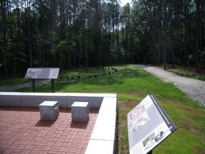
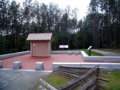
More about this marker. This marker is located within the Fort Christanna Historic Site.
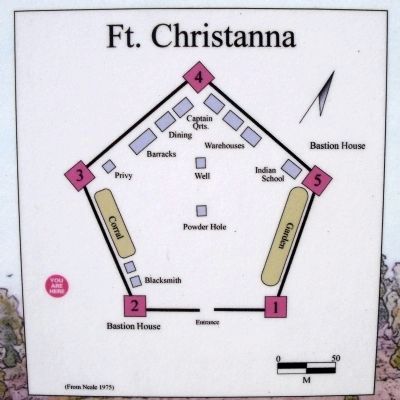
Regarding Fort Christanna: Established 1714. On the left is rendering of the fort. The caption reads, “The fort was pentagonal in shape, with each side one hundred yards long, made of split trees wedged in the earth. At every corner was a bastion house, each with a 1,400 pound cannon. Inside were a number of buildings to house the twelve rangers, the Indian school, and for tade items, animals and storage. A well on the property provide water.” Conceptual Rendering, 2004 by John W. Kincheloe, III.
In the center is the “First map known to show Fort Christanna. Virginia Marylandia et Carolina, c. 1714 by J.B. Homann, courtesy Library of Congress.”
On the right are photos of artifacts from this site with the caption, “Archaeological efforts in 1978-1981 and 2001-2004 have determined the outline of the fort's walls, the locations of some buildings, and the nature of trade items at the fort. Artifacts such as the wine bottle and jew's harp can be seen at the Brunswick County Museum in Lawrenceville.”
Credits. This page was last revised on December 18, 2019. It was originally submitted on June 23, 2009, by Bernard Fisher of Richmond, Virginia. This page has been viewed 4,669 times since then and 46 times this year. Photos: 1, 2, 3, 4, 5, 6. submitted on June 23, 2009, by Bernard Fisher of Richmond, Virginia.
