Columbia in Howard County, Maryland — The American Northeast (Mid-Atlantic)
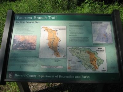
The Little Patuxent River
Patuxent Branch Trail
River Facts
The Little Patuxent River begins in Howard County near Alpha Ridge.
It is joined by the Middle Patuxent River near Savage.
It continues south to join the Patuxent River near Crofton in Anne Arundel County.
The total length of the Little Patuxent river is 45 miles.
The Little Patuxent River flows 25 miles in Howard County.
The median daily flow at Guilford is 44 cubic feet per second.
The greates flow at Guilford was during Hurricane Agnes in 1972, at 12,400 cubic feet per second.
The average depth of the river at Guilford is 2.5 feet.
The highest flooding at Guilford was 18.38 feet during Hurricane Agnes.
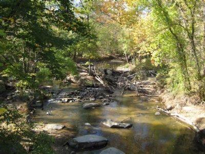
The Little Patuxent River today provides scenic views and recreation, as well as habitat for fish and wildlife. Once it provided power for sawmills, gristmills, and cotton mills.
What is a Watershed?
The total land area that catches rain and drains it to a specific body of water is called a watershed. it is similar to a basin that catches water, and then pours it into a larger basin. Each small stream or tributary has its own watershed, which is part of a larger watershed of a bigger body of water.
Nature, not man, defines the boundaries of a watershed. Anywhere you stand on the earth you are standing in a watershed. Right now you are standing in the Little Patuxent River Watershed. This watershed is part of a the even larger Patuxent River Watershed, and that is part of the far greater Chesepeakde Bay Watershed. So you are standing in several watersheds at once!
Watersheds are important to the health of the body of water that they supply, and that, in turn, affects the total environment. Everything that contaminates water in a watershed can pollute the river or lake at the end of its journey. A drop of water falling here will find its way to the Chesapeake Bay.
These lakes are all on tributaries of the Little Patuxent River:
Centennial Lake
Lake Elkhorn
Lake Kittimaqundi
Wilde Lake
The name "Patuxent" comes from the Algonquian word for "rapids."
Watershed areas
The Little Patuxent Watershed totals 103 square miles. Its area within Howard County is 51.2 square miles.
The Patuxent Watershed totals 956 square miles. Its area within Howard County is 185 square miles.
The Chesapeake Bay Watershed totals 64,000 square miles. It covers all of Howard County: 250 square miles. It covers almost all of Maryland: 12,000 square miles. It covers parts of 6 states: NY, PA, DE, MD, VA, WV.
What is the "Fall Line"? As rivers
flow from the higher Piedmont Plateau to the lower Coastal Plain in Maryland, their descent creates many waterfalls and rapids. This edge, which generally follows interstate Route 95, has long been called the Fall Line. It marks the point where upstream navigation becomes difficult and the energy of the falling water can be harnessed to power mills and factories. Often the water has carved a narrow gorge through the harder rocks. Between Guilford and Savage, the river drops nearly 60 feet.
The Chesapeake Bay Watershed covers 1.7% of the landmass of the United States, yet it contains 5.2% of the total population.
80% of Howard County is in the Patuxent River Watershed, and 20% is in the Patapsco River watershed.
Erected 2003 by Howard County Department of Recreation and Parks.
Topics. This historical marker is listed in these topic lists: Environment • Industry & Commerce • Waterways & Vessels. A significant historical year for this entry is 1972.
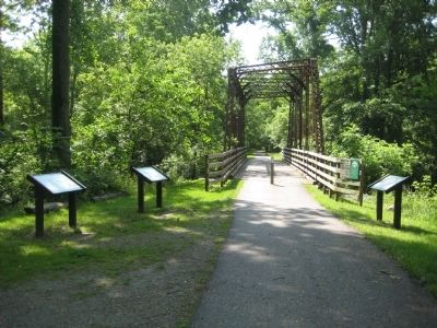
Location. 39° 9.945′ N, 76° 50.468′ W. Marker is in Columbia, Maryland, in Howard County. Marker can be reached from Old Guilford Road, 0 miles south of Guilford Road when traveling south. Marker is on the trail near the parking lot, on the north side of the restored bridge of the Little Patuxent River. Touch for map
. Marker is in this post office area: Columbia MD 21046, United States of America. Touch for directions.
Other nearby markers. At least 8 other markers are within 2 miles of this marker, measured as the crow flies. The Pratt Through-Truss Bridge (a few steps from this marker); The Granite Quarries (a few steps from this marker); The Patuxent Branch of the B&O Railroad (within shouting distance of this marker); The Town of Guilford (within shouting distance of this marker); Maryland Purple Heart Trail (approx. 1.4 miles away); Governor Harry R. Hughes (approx. 1.4 miles away); Explore your Chesapeake (approx. 1.4 miles away); Christ Episcopal Church (approx. 1½ miles away). Touch for a list and map of all markers in Columbia.
Credits. This page was last revised on February 18, 2021. It was originally submitted on July 3, 2009, by F. Robby of Baltimore, Maryland. This page has been viewed 3,607 times since then and 323 times this year. Photos: 1, 2, 3. submitted on July 3, 2009, by F. Robby of Baltimore, Maryland.


