Olde Towne in Portsmouth, Virginia — The American South (Mid-Atlantic)
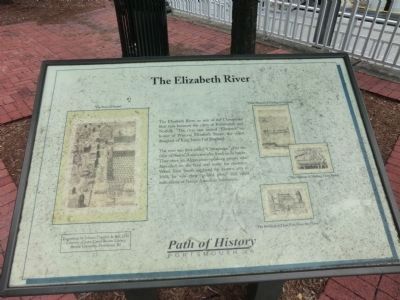
The Elizabeth River
The river was first called “Chesapeake,” after the tribe of Native Americans who lived on its banks. They were an Algonquin-speaking people who depended on the land and water for existence. When John Smith explored the eastern area in 1608, he saw their “golden plots” and other indications of Native American habitation.
Topics. This historical marker is listed in these topic lists: Colonial Era • Exploration • Waterways & Vessels. A significant historical year for this entry is 1608.
Location. 36° 50.104′ N, 76° 17.77′ W. Marker is in Portsmouth, Virginia. It is in Olde Towne. Marker can be reached from the intersection of High Street and Water Street, on the right when traveling east. Along the seawall at the High Street ferry landing. Touch for map. Marker is in this post office area: Portsmouth VA 23704, United States of America. Touch for directions.
Other nearby markers. At least 8 other markers are within walking distance of this marker. First Order Fresnel Lens from the Hog Island Light (within shouting distance of this marker); Seaboard Air Line Railroad (within shouting distance of this marker); In Commemoration of the Last Public Appearance of William F. “Buffalo Bill” Cody (about 300 feet away, measured in a direct line); Naval Shipyard Museum (about 300 feet away); John Luke Porter (about 300 feet away); Cornwallis' Embarkation (about 300 feet away); Revolutionary War at Portsmouth (about 400 feet away); Home Site of William Crawford (d. 1762) Founder of Portsmouth (about 400 feet away). Touch for a list and map of all markers in Portsmouth.
Credits. This page was last revised on February 1, 2023. It was originally submitted on July 28, 2009, by Kristin Rollins of Portsmouth, Virginia. This page has been viewed 745 times since then and 33 times this year. Photo 1. submitted on September 18, 2012, by Don Morfe of Baltimore, Maryland. • Kevin W. was the editor who published this page.
