Near Burkittsville in Frederick County, Maryland — The American Northeast (Mid-Atlantic)
Troup Light Artillery
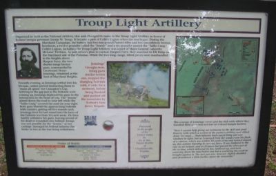
Organized in 1858 as the National Artillery, this unit changed its name to the Troup Light Artillery in honor of the former Georgia governor George W. Troup. It became a part of Cobb’s Legion when the war began. During the Maryland Campaign, the battery had two ten-pound Parrott rifles and two smoothbore bronze howitzers, a twelve-pounder called “Jennie” and a six-pounder named the “Sallie Craig.” Cobb’s Legion, including the Troup Light Artillery, was part of Major General Lafayette McLaws’ Division. As part of Lee’s plan to capture Harpers Ferry, they marched to Elk Ridge on the Maryland side of the Potomac. While the two long-range, rifled pieces were manhandled to the heights above Harpers Ferry, the two shorter range bronze guns, commanded by Lieutenant Henry Jennings, remained at the foot of Maryland Heights.
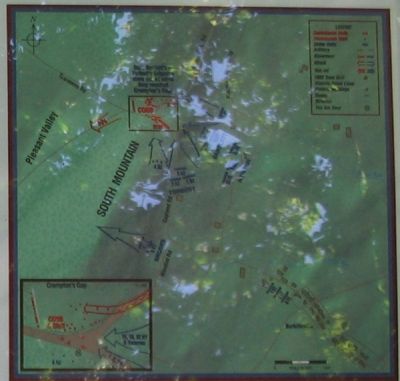
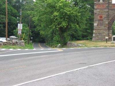
Towards evening, as Jennings settled into his bivouac, orders arrived instructing them to “make all speed” for Crampton’s Gap. Arriving in the gap just as the Federals were coming up, Jennings deployed his guns in the intersection to the front of you. The “Jennie” aimed down the road to your left while the “Sallie Craig” covered the road on your right. Both guns blasted the approaching Federals with canister, getting off five rounds into the faces of the Federals less than 50 yards away. He then hastily withdrew his guns, leaving several of his dead or wounded crew behind. Escape was not possible for the “Jennie,” as her carriage, damaged by Federal infantry fire, broke in two as she was being withdrawn.
The Courage of Jennings’ crew and the skill with which they handled their guns was not lost on Colonel Joseph Bartlett:
“Here I cannot help giving my testimony to the skill and great bravery with which a section of the enemy’s artillery was retired down the road.... Their infantry had ceased firing and was nowhere in sight, but as I emerged from the woods I saw the flash of a cannon, which was within 50 yards of me and trained toward us, the cannister bursting in our very faces. It was limbered to the rear in an instance, and at 20 paces had passed the other gun of the section, which delivered its fire, limbered up, and went scurrying down the road before any but a scattering fire could be brought against it. The last gun was, however, slightly disabled, and abandoned a little further down the mountain.”
Order of Battle
Confederate States of America
Brig. Gen. Howell Cobb
16th Ga., 24th Ga., Cobb’s Legion, 15th N.C., Troup Light Art.
United States of America
Col. Joseph J. Bartlett (Composite Command)
32nd N.Y., 16th N.Y., 18th N.Y., 96th Pa. & Reserves
Col. Alfred T.A. Torbet
1st N.J., 2nd N.J., 3rd N.J., 4th N.J.
Presented to the people of the United States by Dr. & Mrs. Daniel Beattie of Charlottsville, Virginia.
Erected by Blue & Gray Educational Society / State of Maryland Department of Natural Resources.
Topics. This historical marker is listed in this topic list: War, US Civil. A significant historical year for this entry is 1858.
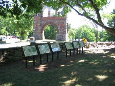
Location. 39° 24.312′ N, 77° 38.364′ W. Marker is near Burkittsville, Maryland, in Frederick County. Marker is at the intersection of Gapland Raod and Arnoldstown Road, on the left when traveling west on Gapland Raod. Across the road from the War Correspondent’s Memorial Arch, in Gathland State Park. Touch for map. Marker is in this post office area: Burkittsville MD 21718, United States of America. Touch for directions.
Other nearby markers. At least 8 other markers are within walking distance of this marker. The Stage is Set (here, next to this marker); Bartlett Leads the Way (here, next to this marker); Medal of Honor Recipients (here, next to this marker); Padgett’s Field: Confederate Last Stand (here, next to this marker); Burial: A Most Disagreeable Task (here, next to this marker); Journalists Who Gave Their Lives (within shouting distance of this marker); GATH: The Man and His Mountain (within shouting distance of this marker); Gath's Empty Tomb (within shouting distance of this marker). Touch for a list and map of all markers in Burkittsville.


