Near Burkittsville in Frederick County, Maryland — The American Northeast (Mid-Atlantic)
Padgett’s Field: Confederate Last Stand
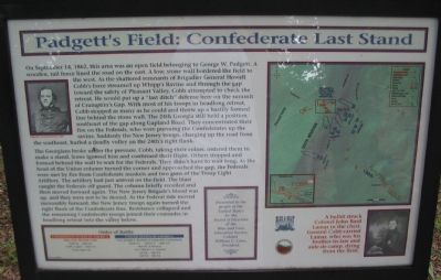
On September 14, 1862, this area was an open field belonging to George W. Padgett. A wooden, rail fence lined the road on the east. A low, stone wall bordered the field to the west. As the shattered remnants of Brigadier General Howell Cobb’s force streamed up Whipp’s Ravine and through the gap toward the safety of Pleasant Valley, Cobb attempted to check the retreat. He would put up a “last ditch” defense here on the summit of Crampton's Gap. With most of his troops in headlong retreat, Cobb stopped as many as he could and threw up a hastily formed line behind the stone wall. The 24th Georgia still held a position southeast of the gap along Gapland Road. They concentrated their fire on the Federals, who were pursuing the Confederates up the ravine. Suddenly the New Jersey troops, charging up the road from the southeast, hurled a deadly volley on the 24th's right flank.
The Georgians broke under pressure. Cobb, taking their colors, ordered them to make a stand. Some ignored him and continued their flight. Others stopped and formed behind the wall to wait for the Federals. They didn’t have to wait long. As the head of the Union column turned the corner and approached the gap, the Federals were met by fire from Confederate muskets and two guns of the Troup Light Artillery. The artillery had just arrived on the field. The blast caught the Federals off guard. The column briefly recoiled and then moved forward again. The New Jersey Brigade’s blood was up, and they were not to be denied. As the Federal tide moved inexorably forward, the New Jersey troops again turned the right flank of the Confederate line. Resistance collapsed and the remaining Confederate troops joined their comrades in headlong retreat into the valley below.
Order of Battle
Confederate States of America
Brig. Gen. Howell Cobb
16th Ga., 24th Ga., Cobb’s Legion, 15th N.C., Troup Light Art.
United States of America
Col. Joseph J. Bartlett (Composite Command)
32nd N.Y., 16th N.Y., 18th N.Y., 96th Pa. & Reserves
Col. Alfred T.A. Torbet
1st N.J., 2nd N.J., 3rd N.J., 4th N.J.
Presented to the people of the United States by the Board of Directors of the Blue and Gray Education Society, Colonel William C. Lowe, President.
Erected by Blue & Gray Educational Society / State of Maryland Department of Natural Resources.
Topics. This historical marker is listed in this topic list: War, US Civil. A significant historical month for this entry is September 1858.
Location. 39° 24.312′ N, 77° 38.364′ W. Marker is near Burkittsville, Maryland, in Frederick County. Marker is at the intersection of Gapland Raod and Arnoldstown Road, on the left when traveling west on Gapland Raod. Across the road from the War Correspondent’s Memorial Arch, in Gathland State Park. Touch for map. Marker is in this post office area: Burkittsville MD 21718, United States of America. Touch for directions.
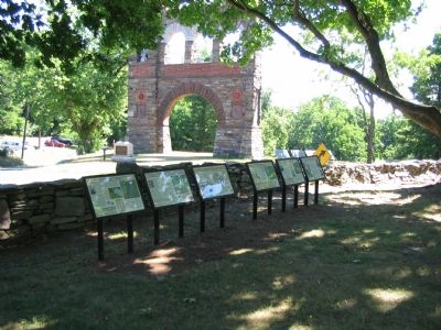
Other nearby markers. At least 8 other markers are within walking distance of this marker. The Stage is Set (here, next to this marker); Bartlett Leads the Way (here, next to this marker); Medal of Honor Recipients (here, next to this marker); Troup Light Artillery (here, next to this marker); Burial: A Most Disagreeable Task (here, next to this marker); Journalists Who Gave Their Lives (within shouting distance of this marker); GATH: The Man and His Mountain (within shouting distance of this marker); Gath's Empty Tomb (within shouting distance of this marker). Touch for a list and map of all markers in Burkittsville.
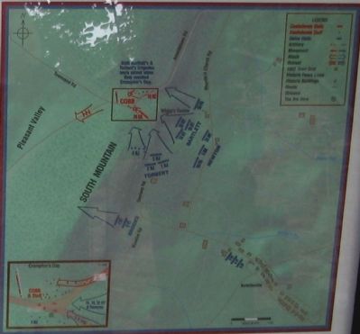
More about this marker. The marker has a portrait of Brigadier General Howell Cobb on the left. On the right side is a map detailing the tactical situation described on the marker. A portrait of Colonel John Basil Lamar carries the caption, “A bullet struck Colonel John Basil Lamar in the chest. General Cobb carried Lamar, who was his brother-in-law and aide-de-camp, dying from the field.”
Also see . . .
1. Crampton’s Gap on South Mountain. Stone Sentinels website entry (Submitted on April 25, 2022, by Larry Gertner of New York, New York.)
2. BGen Howell Cobb's Official Report. Antietam on the Web entry (Submitted on August 22, 2007, by Craig Swain of Leesburg, Virginia.)
3. 24th Georgia Infantry Regiment. Civil War in the East website entry (Submitted on March 3, 2022, by Larry Gertner of New York, New York.)

Photographed By Craig Swain, August 5, 2007
4. Stone Walls
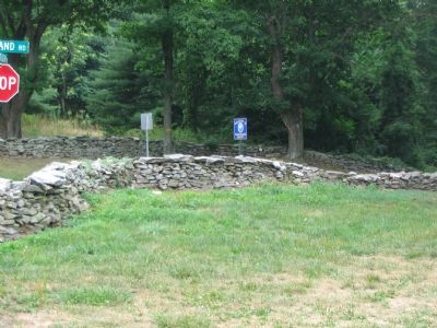
These stone walls on the west side of the intersection are of post war construction, associated with George Townsend's estate, but are generally oriented along the same lines as those used by Cobb's force in the last ditch defense described on the marker.
Credits. This page was last revised on April 25, 2022. It was originally submitted on August 22, 2007, by Craig Swain of Leesburg, Virginia. This page has been viewed 1,809 times since then and 23 times this year. Photos: 1, 2, 3, 4. submitted on August 22, 2007, by Craig Swain of Leesburg, Virginia. • J. J. Prats was the editor who published this page.


