Buckhead in Atlanta in Fulton County, Georgia — The American South (South Atlantic)
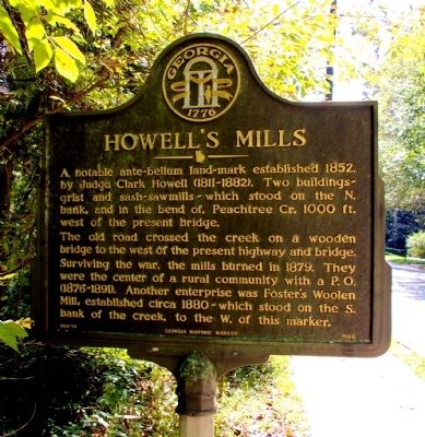
Howell's Mills
The old road crossed the creek on a wooden bridge to the west of the present highway and bridge. Surviving the war, the mills burned in 1879. They were the center of a rural community with a P.O. (1876-1891). Another enterprise was Foster’s Woolen Mill, established circa 1880 -- which stood on the S. bank of the creek, to the W. of this marker.
Erected 1989 by Georgia Department of Natural Resources. (Marker Number 060-51.)
Topics and series. This historical marker is listed in these topic lists: Industry & Commerce • Waterways & Vessels. In addition, it is included in the Georgia Historical Society series list. A significant historical year for this entry is 1852.
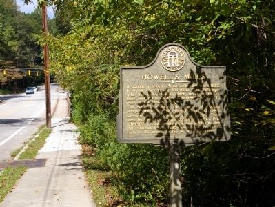
Location. 33° 49.417′ N, 84° 24.956′ W. Marker is in Atlanta, Georgia, in Fulton County. It is in Buckhead. Marker is on Howell Mill Road, 0.1 miles south of Peachtree Battle Road, on the left when traveling south. The marker is just to the south of the bridge over Peachtree Creek. Touch for map. Marker is in this post office area: Atlanta GA 30309, United States of America. Touch for directions.
Other nearby markers. At least 8 other markers are within walking distance of this marker. Reynold’s Brigade (here, next to this marker); Federal Crossings (here, next to this marker); Geary’s Div. to Peachtree Creek (approx. 0.3 miles away); Geary’s Three Bridges (approx. half a mile away); Rt. Of 20th A.C. Line (approx. 0.6 miles away); Williams' Div. Deployed (approx. 0.9 miles away); O’Neal’s Brigade at the Ravine (approx. 0.9 miles away); Disputed Passage (approx. 0.9 miles away). Touch for a list and map of all markers in Atlanta.
More about this marker. This marker replaced an earlier marker of the same title and text on this location erected by the Georgia Historical Commission.
Credits. This page was last revised on February 8, 2023. It was originally submitted on October 13, 2009, by David Seibert of Sandy Springs, Georgia. This page has been viewed 1,042 times since then and 47 times this year. Photos: 1, 2. submitted on October 13, 2009, by David Seibert of Sandy Springs, Georgia. • Craig Swain was the editor who published this page.

