Montpelier Station in Orange County, Virginia — The American South (Mid-Atlantic)
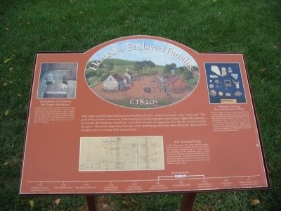
Homes for Enslaved Families
c. 1820s
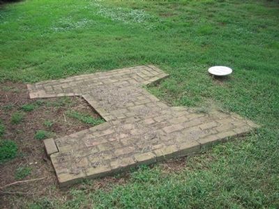
Foundation of Chimney for Duplex Residence
Archaeologists have excavated the site of one of the houses in the south yard. The form of the foundation shows that the home was a duplex with a central chimney. Other evidence shows that the home had a wood floor, glass windows, and was well built - much different from the crude log dwellings that field slaves lived in just a quarter-mile away.
Personal Artifacts Recovered from a Home
Buttons, beads, ceramics, and glassware were excavated from one home in the south yard, and were among the few personal belongings of slaves. They would have purchased these items at local markets and stores. It was common for slaves to earn money by selling vegetables they grew or by working in their limited spare time. Dolley's niece recalls her aunt buying cabbages, sweet potatoes, chickens, and eggs from "Old Sawney," who might have lived in one of these homes.
1837 Insurance Map
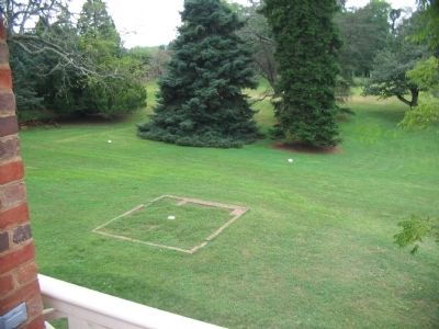
In 1837, about a year after James Madison's death, Dolley insured the home and nearby outbuildings. The insurance company's map, to the left, shows these buildings. Three residences, each a duplex for two slave families, and two smokehouses once stood in this area. The kitchen (the brick structure in the painting above) is absent in this insurance map, suggesting that the structure was not of enough value to insure in 1837.
Topics and series. This historical marker is listed in these topic lists: African Americans • Agriculture • Anthropology & Archaeology • Industry & Commerce • Settlements & Settlers. In addition, it is included in the Former U.S. Presidents: #04 James Madison series list. A significant historical year for this entry is 1837.
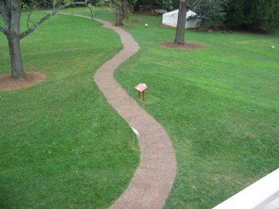
Location. 38° 13.11′ N, 78° 10.114′ W. Marker is in Montpelier Station, Virginia, in Orange County. Marker can be reached from Montpelier Road, on the right when traveling south. Located on the Montpelier Estate, behind the house on a trail leading to the Annie DuPont Formal Garden. Touch for map. Marker is in this post office area: Montpelier Station VA 22957, United States of America. Touch for directions.
Other nearby markers. At least 8 other markers are within walking distance of this marker. The Backyard (here, next to this marker); The Quarters (within shouting distance of this marker); The Road (within shouting distance of this marker); The Garden (about 300 feet away, measured in a direct line); The Blacksmith Shop (about 500 feet away); Madison Farm Complex (about 600 feet away); The African American Cemetery (approx. ¼ mile away); Slave Cemetery (approx. ¼ mile away). Touch for a list and map of all markers in Montpelier Station.
More about this marker. Illustrations on the marker include the depiction of the slave quarters, excavated chimney stones, artifacts, and the insurance map discussed in the text. At the bottom is a time line indicating the south yard was in use between 1817 and 1844; the span between when Madisons retired from public life and when Dolley Madison sold Montpelier.
Also see . . . Archaeology at Montpelier. (Submitted on November 1, 2009, by Craig Swain of Leesburg, Virginia.)
Credits. This page was last revised on February 3, 2020. It was originally submitted on November 1, 2009, by Craig Swain of Leesburg, Virginia. This page has been viewed 771 times since then and 11 times this year. Photos: 1, 2, 3, 4. submitted on November 1, 2009, by Craig Swain of Leesburg, Virginia.


