Central Office District in Richmond, Virginia — The American South (Mid-Atlantic)
Great Turning Basin
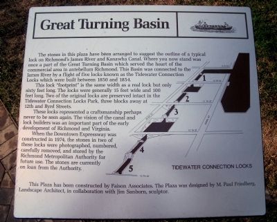
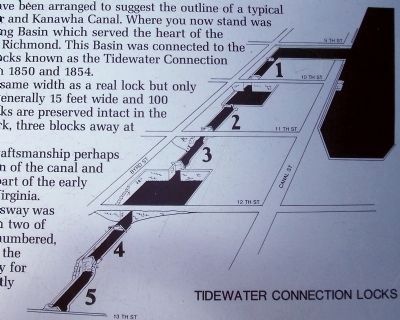
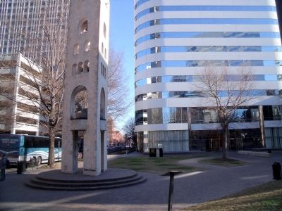
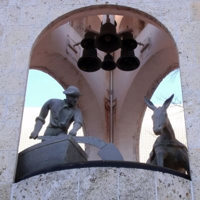
The stones in this plaza have been arranged to suggest the outline of a typical lock on Richmond’s James River and Kanawha Canal. Where you now stand was once a part of the Great Turning Basin which served the heart of the commercial area in antebellum Richmond. This Basin was connected to the James River by a flight of five locks known as the Tidewater Connection Locks which were built between 1850 and 1854.
This lock “footprint” is the same width as a real lock but only sixty feet long. The locks were generally 15 feet wide and 100 feet long. Two of the original locks are preserved intact in the Tidewater Connection Locks Park, three blocks away at 12th and Byrd Streets.
These locks represented a craftsmanship perhaps never to be seen again. The vision of the canal and lock builders was an important part of the early development of Richmond and Virginia.
When the Downtown Expressway was constructed in 1974, the stones in two of these locks were photographed, numbered, carefully removed, and stored by the Richmond Metropolitan Authority for future use. The stones are currently on loan from the Authority.
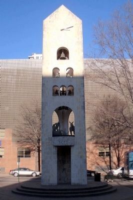
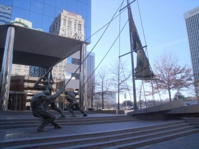
This Plaza has been constructed by Faison Associates. The Plaza was designed by M. Paul Friedberg, Landscape Architect, in collaboration with Jim Sanborn, sculptor.
Topics. This historical marker is listed in these topic lists: Industry & Commerce • Waterways & Vessels. A significant historical year for this entry is 1850.
Location. 37° 32.194′ N, 77° 26.173′ W. Marker is in Richmond, Virginia. It is in the Central Office District. Marker can be reached from the intersection of South 10th Street and East Cary Street. This marker is located in James Center Plaza. Touch for map. Marker is in this post office area: Richmond VA 23219, United States of America. Touch for directions.
Other nearby markers. At least 8 other markers are within walking distance of this marker. A different marker also named Great Turning Basin (within shouting distance of this marker); Oliver White Hill Sr. (about 400 feet away, measured in a direct line); Richmond Bread Riot (about 400 feet away); 1201 East Cary Street (about 500 feet away); Richmond Evacuation Fire (about 600 feet away); Spottswood W. Robinson III (about 600 feet away); The First National Bank Building (about 600 feet away); Gallego Mills (about 600 feet away). Touch for a list and map of all markers in Richmond.
Related marker. Click here for another marker that is related to this marker. An identical marker stands nearby.
Also see . . .
1. James Center History. "Most of what is now James Center was occupied by the Great Turning
Basin of the James River and Kanawha Canal. This huge man-made body of water was three blocks long, from what is now 8th Street to 11th Street and one block wide, from just inside Cary Street to Canal Street." (Submitted on January 17, 2010.)
2. James River and Kanawha Canal Historic District. National Register of Historic Places (Submitted on January 18, 2010.)
Credits. This page was last revised on November 10, 2023. It was originally submitted on January 17, 2010, by Bernard Fisher of Richmond, Virginia. This page has been viewed 1,792 times since then and 51 times this year. Photos: 1, 2, 3, 4, 5, 6. submitted on January 17, 2010, by Bernard Fisher of Richmond, Virginia.
