Birmingham in Jefferson County, Alabama — The American South (East South Central)
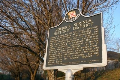
Roebuck Springs Historic District
Erected 2000 by Alabama Historical Association / Roebuck Springs Historical Preservation Society and the City of Birmingham.
Topics and series. This historical marker is listed in these topic lists: Notable Places • Roads & Vehicles • Settlements & Settlers • Sports. In addition, it is included in the Alabama Historical Association series list. A significant historical year for this entry is 1910.
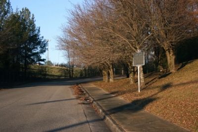
Location. 33° 34.878′ N, 86° 42.39′ W. Marker is in Birmingham, Alabama, in Jefferson County. Marker is on Cumberland Drive east of 4th Avenue South, on the right when traveling east. Touch for map. Marker is in this post office area: Birmingham AL 35206, United States of America. Touch for directions.
Other nearby markers. At least 8 other markers are within 3 miles of this marker, measured as the crow flies. Wilson Chapel And Cemetery (about 600 feet away, measured in a direct line); Roebuck Spring (approx. ¼ mile away); Zion Memorial Gardens (approx. 1.2 miles away); East Lake Park (approx. 1.3 miles away); Ruhama Baptist Church (approx. 1½ miles away); Howard College (approx. 1.8 miles away); East Lake Community (approx. 1.9 miles away); CDR "Snuffy" Smith (approx. 2.2 miles away). Touch for a list and map of all markers in Birmingham.
Credits. This page was last revised on July 25, 2018. It was originally submitted on January 20, 2010, by Timothy Carr of Birmingham, Alabama. This page has been viewed 2,417 times since then and 73 times this year. Photos: 1, 2. submitted on January 20, 2010, by Timothy Carr of Birmingham, Alabama. • Bill Pfingsten was the editor who published this page.

