Charleston in Charleston County, South Carolina — The American South (South Atlantic)
Fort Moultrie
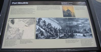
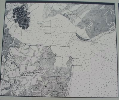
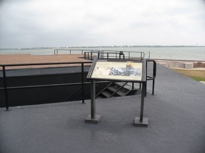
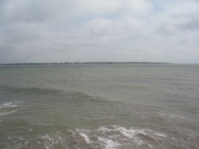
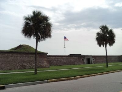
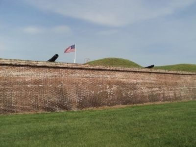
Fort Moultrie, on Sullivan's Island directly in front of you, had been an early harbor defense and was the site of Charleston's famous Revolutionary War palmetto-log fort. Fort Sumter was built here on a shoal opposite Fort Moultrie when America strengthened its seacoast defenses after the War of 1812. Charleston's narrow main ship channel passed between the two forts. Enemy ships venturing there would be trapped in a crossfire of cannon.
With the surrender of Fort Sumter in 1861, Union forces evacuated, leaving Charleston's defenses in Confederate hands. The South effectively controlled the harbor from 1861-65 despite Union blockade and bombardment, and the port of Charleston remained open to daring blockade runners supplying the South.
Erected by Fort Sumter National Monument, South Carolina - National Park Service - U.S. Department of the Interior.
Topics. This historical marker is listed in these topic lists: Forts and Castles • War, US Civil • Waterways & Vessels. A significant historical year for this entry is 1812.
Location. 32° 45.141′ N, 79° 52.475′ W. Marker is in Charleston, South Carolina, in Charleston County. Marker is located at Fort Sumter National Monument and only reached by boat. See links below for more information about access to the site. Touch for map. Marker is in this post office area: Charleston SC 29412, United States of America. Touch for directions.
Other nearby markers. At least 8 other markers are within walking distance of this marker. Flags of the Fort (here, next to this marker); Charleston Besieged (a few steps from this marker); Fort Johnson (a few steps from this marker); Morris Island (a few steps from this marker); Major Robert Anderson (a few steps from this marker); a different marker also named Morris Island (a few steps from this marker); 8-inch (200 Pounder) Parrott (a few steps from this marker); Fort Sumter Today (within shouting distance of this marker). Touch for a list and map of all markers in Charleston.
More about this marker. On the lower left is a map of Charleston harbor with the defenses noted. This 1863 map illustrates the strategic importance of Fort Moultrie and Fort Sumter in controlling the entrance to Charleston Harbor; the narrow main ship channel passed between the two forts. The currents of Charleston Harbor are constantly shifting, and today's channel differs from that of the 1860s.
On the upper right is a portrait of Major Robert Anderson, who assumed command of Union forces at Fort Moultrie in November 1860, on the eve of the Civil War. This Kentucky-born major was the son of a Revolutionary War defender of Charleston.
In the bottom right is an illustration depicting the Federal evacuation of Fort Moultrie. Major Robert Anderson secretly evacuated Fort Moultrie on the night of December 26, 1860, moving his command to Fort Sumter. South Carolina had seceded from the Union six days before, and Anderson realized that his eighty-five men could not hold Fort Moultrie against attack. The move infuriated the secessionists who felt that all harbor forts belonged to South Carolina.
Also see . . . Fort Moultrie. National Park Service page for Fort Moultrie. (Submitted on May 18, 2010, by Craig Swain of Leesburg, Virginia.)
Credits. This page was last revised on October 27, 2020. It was originally submitted on May 18, 2010, by Craig Swain of Leesburg, Virginia. This page has been viewed 1,390 times since then and 63 times this year. Photos: 1, 2, 3, 4. submitted on May 18, 2010, by Craig Swain of Leesburg, Virginia. 5, 6. submitted on August 18, 2013, by Bill Coughlin of Woodland Park, New Jersey.
