Carroll Park in Baltimore, Maryland — The American Northeast (Mid-Atlantic)
Mount Clare
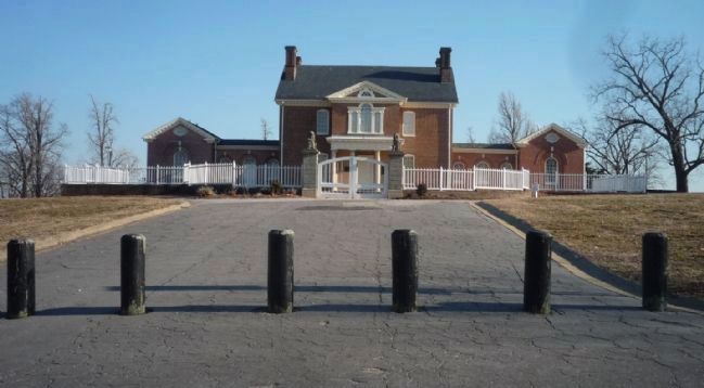
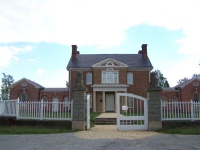
This outstanding Georgian mansion, built between 1754 and 1768, was the home of Charles Carroll, Barrister and framer of Maryland’s first Constitution and Declaration of Rights. Carroll and his wife Margaret Tilghman made Mount Clare a center of enlightened colonial living and the heart of a flourishing plantation, which once supported wheat fields, orchards, racing stables, flour mills, brick kilns and a shipyard. Since 1977, Mount Clare has been the subject of a major archaeological investigation into life in the Tidewater region between 1750 and 1850.
Standing loftily atop the hill, the mansion was an impressive sight to ships sailing up the Patapsco. Rolling pastures and fields stretched up from the river to wide terraced gardens leading up to the house. These gardens and the exotic fruit trees cultivated in the “orangery” were the work of Mrs. Carroll, a noted horticulturist who supplied George Washington with trees and plants for Mount Vernon by sending them down the Patapsco on a sailing vessel.
In the 19th century, industrial development began to encircle Mount Clare as railroad tracks crisscrossed the northern section of the property and the Washington Turnpike sliced through the southern portion. The mansion and remaining acres were purchased by the City in 1890 for a public park, and in 1917, the Colonial Dames of America opened Mount Clare as Maryland’s first historic house museum.
Erected by the City of Baltimore, William Donald Schaefer, mayor.
Topics and series. This historical marker is listed in these topic lists: Agriculture • Colonial Era • Horticulture & Forestry • Settlements & Settlers. In addition, it is included in the Maryland, Baltimore City historical markers, and the National Historic Landmarks series lists. A significant historical year for this entry is 1754.
Location. 39° 16.731′ N, 76° 38.591′ W. Marker is in Baltimore, Maryland. It is in Carroll Park. Marker can be reached from Washington Boulevard. Marker is in on the wall of Mt. Clare at the tour entrance door. Touch for map. Marker is in this post office area: Baltimore MD 21230, United States of America. Touch for directions.
Other nearby markers. At least 8 other markers are within walking distance of this marker. A different marker also named Mount Clare (a few steps from this marker); a different marker also named Mount Clare (within shouting distance of this marker); Camp Carroll (within shouting distance of this marker); 1917 – 1918 (about 400 feet away, measured in a direct line); Joseph Beuys Tree Partnership (approx. 0.2 miles away); Mount Clare, the Georgia Plantation (approx. 0.2 miles away); Carroll Park (approx. 0.2 miles away); Carroll Park at the Historic Pigtown Neighborhood (approx. ¼ mile away). Touch for a list and map of all markers in Baltimore.
Also see . . .
1. Mount Clair. Wikipedia entry (Submitted on November 28, 2023, by Larry Gertner of New York, New York.)
2. Charles Carroll (barrister). Wikipedia entry (Submitted on October 29, 2007, by Bill Pfingsten of Bel Air, Maryland.)
Credits. This page was last revised on November 28, 2023. It was originally submitted on October 25, 2007, by Bill Pfingsten of Bel Air, Maryland. This page has been viewed 2,500 times since then and 23 times this year. Photos: 1. submitted on October 25, 2007, by Bill Pfingsten of Bel Air, Maryland. 2. submitted on April 3, 2011, by Richard E. Miller of Oxon Hill, Maryland. 3. submitted on October 25, 2007, by Bill Pfingsten of Bel Air, Maryland. • J. J. Prats was the editor who published this page.


