Winchester, Virginia — The American South (Mid-Atlantic)
Shawnee Springs Hospital
Valley Campaigns
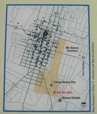
Federal medical authorities established the largest temporary hospital of the Civil War in the aftermath of the Third Battle of Winchester on September 19, 1864. Union Gen. Philip H. Sheridan's medical director, Surgeon James T. Ghiselin, on September 22, ordered Surgeon John H. Brinton to lay out a 4,000-bed facility. Brinton in turn ordered 500 tents and medical supplies for 5,000 patients that had been positioned at Northern rail yards, as well as 20 physicians. Since many public and private structures in Winchester were full of injured Confederates after the battle, the new hospital held Union casualties. Designated Sheridan Field Hospital, the huge facility extended from Shawnee Springs northward to Jacob Senseny's house on Church Ridge. Staff housing and administrative buildings occupied the high ground to your left. Surgeon James V.Z. Blaney assumed command of the hospital on September 28, after Brinton completed its layout.
The hospital quickly treated and evacuated more than 4,000 casualties then became a clearing and evacuation facility. It received patients from engagements farther south, processed them, and moved them to medical facilities in the North. With assistance from United States Sanitary Commission personnel, patients were clothed, fed, and moved on, often in a few hours. The largest surge of patients came after the Battle of Cedar Creek on October 19, when the hospital evacuated 3,400 men between October 23 and 31. Its population dwindled rapidly thereafter, and it sent off its last patient on December 28. The hospital closed on January 4, 1865.
Erected by Virginia Civil War Trails.
Topics and series. This historical marker is listed in this topic list: War, US Civil. In addition, it is included in the Virginia Civil War Trails series list. A significant historical month for this entry is January 1862.
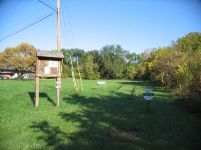
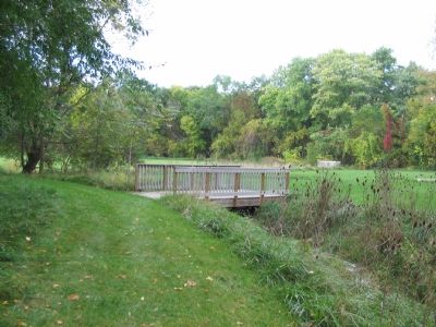
Location. 39° 10.3′ N, 78° 9.73′ W. Marker is in Winchester, Virginia. Marker is on Opequon Avenue, on the right when traveling south. Located in the Shawnee Springs Preserve. From South Pleasant Valley Road, head west on Hollingsworth Drive. From the intersection of Opequon Avenue, turn south. The trail head is on the right. Touch for map. Marker is in this post office area: Winchester VA 22601, United States of America. Touch for directions.
Other nearby markers. At least 8 other markers are within walking distance of this marker. Abram’s Delight (approx. 0.2 miles away); The Hollingsworth Family Settlement (approx. 0.2 miles away); a different marker also named Abram’s Delight (approx. 0.2 miles away); Patsy Cline: Country Music Singer (approx. half a mile away); POW-MIA (approx. half a mile away); First Battle of Winchester (approx. half a mile away); Korean War Memorial (approx. 0.6 miles away); The Korean War (approx. 0.6 miles away). Touch for a list and map of all markers in Winchester.
More about this marker. On the lower right is a map of "Winchester, Then and Now. The dark lines and squares show Civil War-era roads and buildings. Lighter lines are postwar roads. The shaded area is where the immense Sheridan Field Hospital stood. More information about historic Winchester can be obtained at the visitors center at Abrams Delight."
In the upper center are portaits of John H. Brinton (1832-1907) and James T. Ghiselin (1829-1896). On the upper right is a drawing of "Thanksgiving 1864-Raising the Flag at Sheridan Field Hospital" by J.E. Taylor.
Also see . . . Conditions in Civil War Field Hospitals. (Submitted on October 28, 2007, by Craig Swain of Leesburg, Virginia.)
Credits. This page was last revised on December 4, 2021. It was originally submitted on October 28, 2007, by Craig Swain of Leesburg, Virginia. This page has been viewed 3,535 times since then and 76 times this year. Photos: 1, 2, 3, 4. submitted on October 28, 2007, by Craig Swain of Leesburg, Virginia.


