Hardin in Shelby County, Ohio — The American Midwest (Great Lakes)
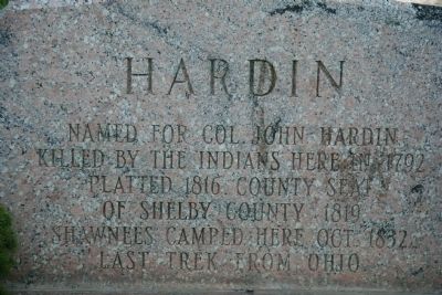
Hardin
Killed by the Indians here in 1792.
Platted 1816. County Seat
Of Shelby County 1819.
Shawnees camped here Oct. 1832
Last trek from Ohio.
Topics. This historical marker is listed in these topic lists: Native Americans • Settlements & Settlers • Wars, US Indian. A significant historical year for this entry is 1792.
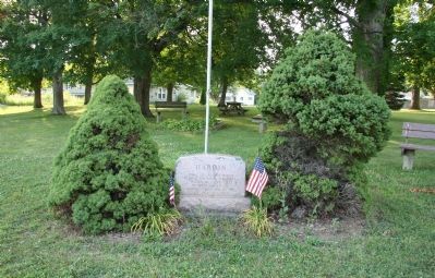
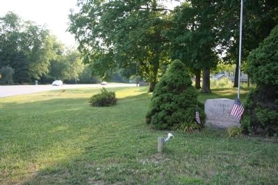
Location. 40° 17.19′ N, 84° 14.724′ W. Marker is in Hardin, Ohio, in Shelby County. Marker is at the intersection of Ohio Route 47 and Hardin-Wapakoneta Road on State Route 47. This historical marker is located in a community park, in the center of a small rural community. It is in the southeast corner of the park, facing the main intersection of the community. Touch for map. Marker is in this post office area: Sidney OH 45365, United States of America. Touch for directions.
Other nearby markers. At least 8 other markers are within 5 miles of this marker, measured as the crow flies. A different marker also named Hardin (within shouting distance of this marker); Brookside Cemetery (approx. half a mile away); First Brick House (approx. 2 miles away); General Harmar Military Trail (approx. 3.1 miles away); Sidney Fire Bell (approx. 4˝ miles away); The Ohio Canals (approx. 4.6 miles away); Monumental Building (approx. 4.7 miles away); George W. Bush (approx. 4.7 miles away).
Regarding Hardin. The small rural community of Hardin, Ohio was named after Colonel John Hardin who played a significant role in a number of conflicts including: Lord Dunmore's War, the Revolutionary War and the Indian Wars of 1790-1795. It is alleged that he was murdered very near the location of this community, while serving on a mission to negotiate a peace treaty with the area Native Americans (see the accompanying links).
Also see . . .
1. John Hardin. From Wikipedia, the free encyclopedia (Submitted on July 15, 2010, by Dale K. Benington of Toledo, Ohio.)
2. John Hardin. This is a link to Answers.com, which claims to be the world's largest Q & A site. (Submitted on July 15, 2010, by Dale K. Benington of Toledo, Ohio.)
3. John Hardin. This is a link to Ohio History Central. on online encyclopedia of Ohio History. (Submitted on July 15, 2010, by Dale K. Benington of Toledo, Ohio.)
Credits. This page was last revised on June 16, 2016. It was originally submitted on July 15, 2010, by Dale K. Benington of Toledo, Ohio. This page has been viewed 894 times since then and 55 times this year. Photos: 1, 2, 3. submitted on July 15, 2010, by Dale K. Benington of Toledo, Ohio.


