Downtown in Hampton, Virginia — The American South (Mid-Atlantic)
St. Johnís Church
The Venerable Survivor
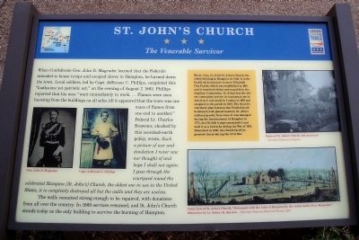
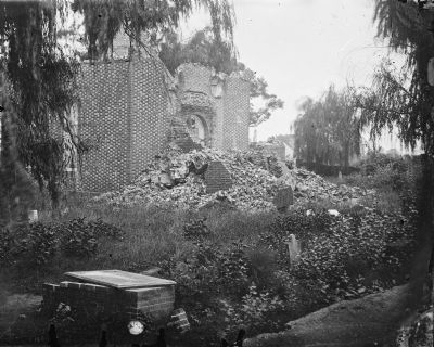
When Confederate Gen. John B. Magruder learned that the Federals intended to house troops and escaped slaves in Hampton, he burned down the town. Local soldiers, led by Capt. Jefferson C. Phillips, completed this “loathsome yet patriotic act,” on the evening of August 7, 1862. Phillips reported that his men “went immediately to work. Ö Flames were seen bursting from the buildings on all sides till it appeared that the town was one mass of flames from one end to another.” Federal Lt. Charles Brewster, shocked by this scorched-earth policy, wrote, Such a picture of war and desolation I never saw nor thought of and hope I shall not again. I pass through the courtyard round the celebrated Hampton [St. Johnís] Church, the oldest one in use in the United States, it is completely destroyed all but the walls and they are useless.
The walls remained strong enough to be repaired, with donations from all over the country. In 1869 services resumed, and St. Johnís Church stands today as the only building to survive the burning of Hampton.
[Sidebar:]
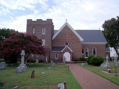
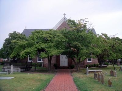
Henry Cary, Jr., built St. Johnís Church, the oldest building in Hampton, in 1728. It is the fourth such structure to serve Elizabeth City Parish, which was established in 1610 and is Americaís oldest active parish in the Anglican Communion. St. Johnís has the oldest communion service in continuous use in America; it was made in London in 1618 and assigned to the parish in 1627. The churchís cruciform plan features fine Flemish-bond brickwork with glazed headers. St. Johnís suffered greatly from wars. It was damaged during the bombardment of Hampton in 1775, and British troops ransacked it and used it as a barracks during the War of 1812. Renovated in 1830, the church faced its greatest threat during the Civil War.
Erected by Virginia Civil War Trails.
Topics and series. This historical marker is listed in these topic lists: Churches & Religion • Colonial Era • War, US Civil • War, US Revolutionary. In addition, it is included in the Virginia Civil War Trails series list. A significant historical year for this entry is 1862.
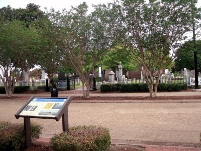
Location. This marker has been replaced by another marker nearby. It was located near 37° 1.533′ N, 76° 20.795′ W. Marker was in Hampton, Virginia. It was in Downtown. Marker was at the intersection of West Queens Way and High Court Lane, on the right when traveling east on West Queens Way. Touch for map. Marker was at or near this postal address: 101 W Queens Way, Hampton VA 23669, United States of America. Touch for directions.
Other nearby markers. At least 8 other markers are within walking distance of this location. A different marker also named St. John's Church (here, next to this marker); War of 1812 Veterans Interred or Memorialized in this Historic Cemetery (a few steps from this marker); Founders And Patriots Buried In This Cemetery (a few steps from this marker); a different marker also named St. John's Church (a few steps from this marker); a different marker also named St. Johnís Church (within shouting distance of this marker); Hampton Confederate Monument (within shouting distance of this marker); a different marker also named St. John's Church (within shouting distance of this marker); Elizabeth City Parish (within shouting distance of this marker). Touch for a list and map of all markers in Hampton.
More about this marker. On the left are images of “Gen. John B. Magruder” and “Capt. Jefferson C. Phillips”.
On the upper right is a photograph of the “Ruins of St. Johnís Church and graveyard” – Courtesy Library of Congress
On the lower right is a watercolor carrying the caption, “Front view of St. Johnís Church. Destroyed with the town of Hampton by the rebels under Gen. Magruder. Watercolr by Lt. Robert K. Sneden.” – Copyright Virginia Historical Society, 1977
Related marker. Click here for another marker that is related to this marker. This marker has been replaced with the linked marker.
Also see . . . Brief History of St. John's Episcopal Church. (Submitted on August 1, 2010, by Bernard Fisher of Richmond, Virginia.)
Credits. This page was last revised on February 1, 2023. It was originally submitted on August 1, 2010, by Bernard Fisher of Richmond, Virginia. This page has been viewed 1,458 times since then and 35 times this year. Photos: 1, 2, 3, 4, 5. submitted on August 1, 2010, by Bernard Fisher of Richmond, Virginia.
