Harlandale in San Antonio in Bexar County, Texas — The American South (West South Central)
San Antonio Missions / Las misiones de San Antonio
Inscription.
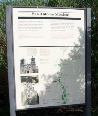
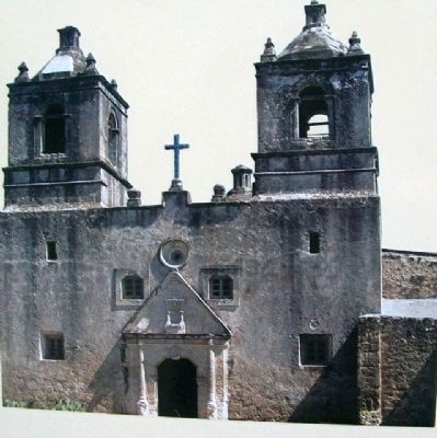
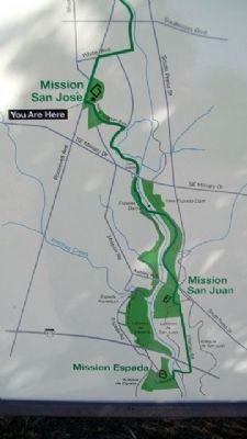
The missions of San Antonio were far more than just churches, they were communities. Each was a fortified village, with its own church, farm, and ranch. Here, Franciscan friars gathered native peoples, converted them to Catholicism, taught them to live as Spaniards, and helped maintain Spanish control over the Texas frontier.
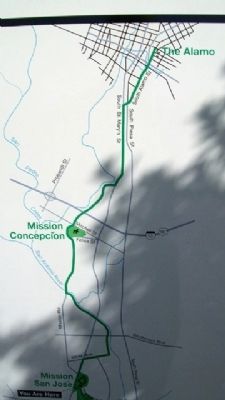
The Franciscans established six missions along the San Antonio River in the early 1700s. Five of them flourished and, with the Villa de San Fernando, became the foundation of the city of San Antonio. Today the missions are elegant reminders of the contribution of Indian and Hispanic peoples to the history of the United States.
The National Park Service maintains and preserves the mission sites through cooperative agreements with the Archdiocese of San Antonio and the state of Texas. The mission churches remain active centers of worship.
The Alamo - established in 1718 as Mission San Antonio de Valero. The Daughters of the Republic of Texas maintains this site as a memorial to Texas Independence.
——————
Las misiones de San Antonio eran mucho más que iglesias, eran comunidades. Cada una era una aldea fortificada, con su propia iglesia, granja y rancho. Aquí, los frailes franciscanos reunían a los nativos, les convertían al catolicismo y les enseñaban a vivir como españoles, y ayudaban a mantener el dominio español sobre la frontera de Texas.
Los franciscanos establecieron seis misiones a principios del siglo XVIII a lo largo del río San Antonio. Cinco de ellas florecieron, y con la Villa de San Fernando, pasaron a ser los cimientos de lo que es hoy la ciudad de San Antonio. Hoy, las misiones son elegantes recordatorios de la contribución aportada por las gentes indígenas e hispanas a la historia de los Estados Unidos.
El Servicio de Parques Nacionales mantiene y conserva los recinto de las misiones a través de acuerdos de cooperación con la Arquidiócesis de San Antonio y el estado de Texas. Las iglesias de la misiones permanecen como parroquias activas.
El Alamo - establecido en 1718 como la Misión San Antonio de Valero. Las Hijas de la República de Texas mantienen este lugar como monumento a la independencia de Texas.
Erected by National Park Service.
Topics. This historical marker is listed in these topic lists: Churches & Religion • Hispanic Americans • Native Americans • Settlements & Settlers. A significant historical year for this entry is 1718.
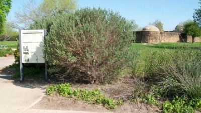
Location. 29° 21.617′ N, 98° 28.79′ W. Marker is in San Antonio, Texas, in Bexar County. It is in Harlandale. Marker is immediately
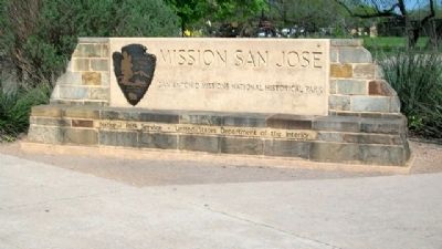
east of the San Antonio Missions National Historic Park Visitor Center (at Mission San Jose). Touch for map. Marker is at or near this postal address: 2202 Roosevelt Avenue, San Antonio TX 78210, United States of America. Touch for directions.
Other nearby markers. At least 8 other markers are within walking distance of this marker. The Mission Road / El Camino de las Misiones (within shouting distance of this marker); Mission San José / La Misión de San José (about 300 feet away, measured in a direct line); The Convento / El convento (about 600 feet away); Indian Quarters / Habitaciones de los Indios (about 600 feet away); Rose Window / Ventana de Rosa (about 700 feet away); Fray Antonio Margil de Jesús (about 700 feet away); The Church / La iglesia (approx. 0.2 miles away); Hot Wells Hotel (approx. 0.6 miles away). Touch for a list and map of all markers in San Antonio.
Also see . . . San Antonio Missions National Historical Park. (Submitted on August 3, 2010, by William Fischer, Jr. of Scranton, Pennsylvania.)
Photographed By William Fischer, Jr., March 29, 2010
5. Espada Aqueduct Photo on Marker
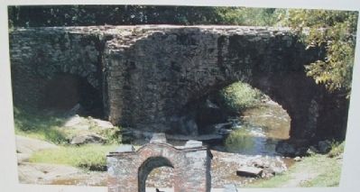
[Caption reads] The Espada Aqueduct was part of an extensive system of irrigation ditches called acequias that watered the mission's fields.
El acueducto de la Espada era parte de un extenso sistema de acequias que regaban las labores de la misión.
El acueducto de la Espada era parte de un extenso sistema de acequias que regaban las labores de la misión.
Photographed By William Fischer, Jr., March 29, 2010
7. San Antonio Missions Photo on Marker
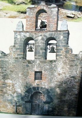
[Caption reads] Mission San Francisco de la Espada was the final mission of the three established in 1731.
La Misión de San Francisco de la Espada fue la última misión de las tres establecidas en el año 1731.
La Misión de San Francisco de la Espada fue la última misión de las tres establecidas en el año 1731.
Credits. This page was last revised on February 2, 2023. It was originally submitted on August 3, 2010, by William Fischer, Jr. of Scranton, Pennsylvania. This page has been viewed 3,087 times since then and 24 times this year. Photos: 1, 2, 3, 4, 5, 6, 7, 8. submitted on August 3, 2010, by William Fischer, Jr. of Scranton, Pennsylvania.
