Olathe in Johnson County, Kansas — The American Midwest (Upper Plains)
Lone Elm Park
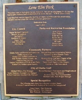
"Travelers came to look upon it as an old friend - they felt an attachment for the tree that had so often sheltered and shaded them from storm and sun..."
W.W.H. Davis (1853)
Lone Elm Park was purchased by the City of Olathe in 2000 to provide preservation, education and enjoyment for current and future generations.
Dedication Date June 9, 2005
Erected 2005 by City of Olathe and Community Partners.
Topics and series. This historical marker is listed in these topic lists: Parks & Recreational Areas • Roads & Vehicles • Settlements & Settlers. In addition, it is included in the Oregon Trail, and the Santa Fe Trail series lists. A significant historical month for this entry is June 1819.
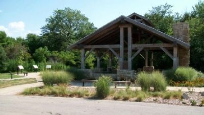
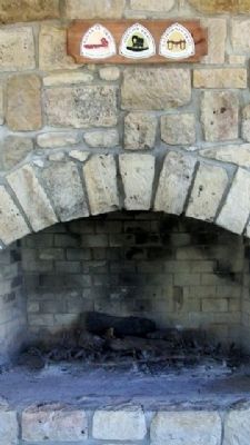
Location. 38° 49.358′ N, 94° 49.826′ W. Marker is in Olathe, Kansas, in Johnson County. Marker is on Lone Elm Park Drive, on the right when traveling east. Marker is on the NE face of the picnic shelter in Lone Elm Park. Touch for map. Marker is at or near this postal address: 21151 West 167th Street, Olathe KS 66062, United States of America. Touch for directions.
Other nearby markers. At least 8 other markers are within walking distance of this marker. Roads To The West (a few steps from this marker); A Most Desirable Spot For Camping (a few steps from this marker); Trail Campground..To Farm..To Park (a few steps from this marker); The Travelers (within shouting distance of this marker); Trails West (about 400 feet away, measured in a direct line); Lone Elm Campground (about 600 feet away); Santa Fe Trail (approx. ¼ mile away); Elm Grove Campground (approx. 0.3 miles away). Touch for a list and map of all markers in Olathe.
Also see . . .
1. Lone Elm Park. Olathe website entry (Submitted on August 12, 2010, by William Fischer, Jr. of Scranton, Pennsylvania.)
2. Santa Fe National Historic Trail. (Submitted on August 12, 2010, by William Fischer, Jr. of Scranton, Pennsylvania.)
Credits. This page was last revised on February 24, 2023. It was originally submitted on August 12, 2010, by William Fischer, Jr. of Scranton, Pennsylvania. This page has been viewed 1,172 times since then and 34 times this year. Photos: 1, 2, 3, 4. submitted on August 12, 2010, by William Fischer, Jr. of Scranton, Pennsylvania. 5. submitted on August 13, 2010, by William Fischer, Jr. of Scranton, Pennsylvania.
