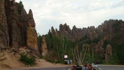
Near Custer in Custer County, South Dakota — The American Midwest (Upper Plains)
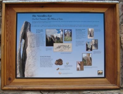
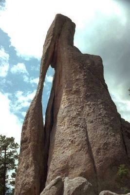
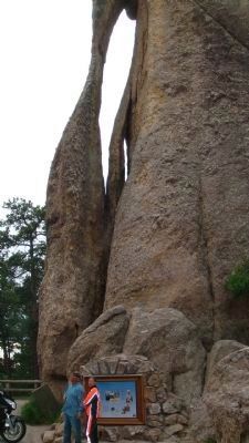
The Needles Eye
One Rock Formation Offers Millions of Stories
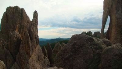
The central core is a region of rocks mainly composed of granite. This area is also home to some of the oldest rocks in North America, dating over two billion years in age. Formed underground and now exposed at the surface, the Black Hills region features a dome-like mass of resistant rocks.
The Black Hills Are an Island in the Plains
The geologic history of the Black Hills is long and complex. In viewing the landscape, you would never guess the region had a history of vast oceans, uplifts, and volcanoes. These natural events, combined with millions of years of erosion and weathering, sculpted the rocks into their present shapes and elevations.
This Roadway Attracts Most Everyone
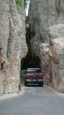
The Needles Highway began attracting public attention upon its completion in 1922. Like past years, visitors continue to drive the narrow roadway to revel in its natural beauty and admire its engineering feat.
Today, sightseers explore more than the roadway, a varied number of recreational activities take place within this rocky terrain.
Do Rocks Have Recipes?
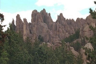
The Needles Eye and Cathedral Spires are made from granite. It is an igneous rock, forming underground from magma (liquid rock). As it pushed upward millions of years ago, the molten rock cooled very slowly. At times, this cooling process yields large crystals which tend to be minerals within one of these three families: feldspar, mica, and quartz.
Caption for largest photo: The Cathedral Spires is perhaps the most famous rock formation in the Black Hills. Its name comes from the towering peaks which appear like organ pipes from the Needles Highway.
Caption for drawing: Kids often observe more than what is expected during a family vacation. Some scenery simply captures their attention and causes them to become more aware of their natural world.
Erected by Custer State Park.
Topics. This historical marker is listed in these topic lists: Natural Features • Roads & Vehicles. A significant historical year for this entry is 1922.
Location. 43° 50.539′ N, 103° 32.744′ W. Marker is near Custer, South Dakota, in Custer County. Marker is on Peter Norbeck Scenic Byway aka Needles Highway (State Highway 87) one mile east of State Highway 89, on the right when traveling west. Touch for map. Marker is in this post office area: Custer SD 57730, United States of America. Touch for directions.
Other nearby markers. At least 8 other markers are within 5 miles of this marker, measured as the crow flies. Harney Peak Lookout (approx. 1.8 miles away);
Photographed By William J. Toman, August 9, 2010
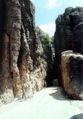
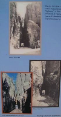
2. Tunnel Photos on The Needles Eye Marker
Top caption: Due to its initial cost, locals referred to this roadway as the "Needless Highway" in the 1920s. However, over the years, it has become a popular byway that enhanced the regional tourism economy.
Lower caption: Touring cars were a common sight along Needles Highway during the 1920s. They have since been replaced by family cars, campers, and tour buses. Past or present, the roadway showcases some of the best scenery in the Black Hills.
Lower caption: Touring cars were a common sight along Needles Highway during the 1920s. They have since been replaced by family cars, campers, and tour buses. Past or present, the roadway showcases some of the best scenery in the Black Hills.
Photographed By William J. Toman, August 9, 2010
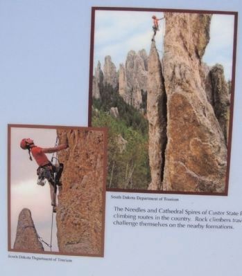
3. Rock Climber Photos on the Needles Eye Marker
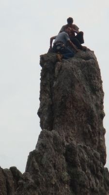
Caption: The Needles Eye and Cathedral Spires of Custer State Park offer some of the best climbing routes in the country. Rock climbers travel from around the world to challenge themselves on the nearby formations.
Photographed By William J. Toman, August 9, 2010
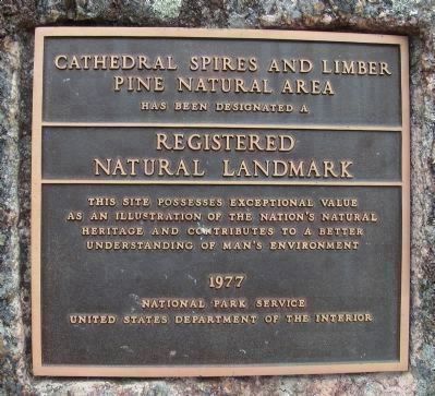
12. Cathedral Spires Marker
The marker reads:
Cathedral Spires and Limber
Pine Natural Area
has been designated a
Registered Natural Landmark
This site possesses exceptional value
as an illustration of the nation's natural
heritage and contributes to a better
understanding of man's environment.
1977
National Park Service
U.S. Department of the Interior
Pine Natural Area
has been designated a
Registered Natural Landmark
This site possesses exceptional value
as an illustration of the nation's natural
heritage and contributes to a better
understanding of man's environment.
1977
National Park Service
U.S. Department of the Interior
Credits. This page was last revised on June 16, 2016. It was originally submitted on August 17, 2010, by William J. Toman of Green Lake, Wisconsin. This page has been viewed 2,394 times since then and 138 times this year. Last updated on August 20, 2010, by William J. Toman of Green Lake, Wisconsin. Photos: 1, 2. submitted on August 17, 2010, by William J. Toman of Green Lake, Wisconsin. 3. submitted on August 19, 2010, by William J. Toman of Green Lake, Wisconsin. 4. submitted on August 19, 2010, by Mike Stroud of Bluffton, South Carolina. 5. submitted on August 19, 2010, by William J. Toman of Green Lake, Wisconsin. 6, 7. submitted on August 19, 2010, by Mike Stroud of Bluffton, South Carolina. 8, 9, 10, 11, 12, 13. submitted on August 19, 2010, by William J. Toman of Green Lake, Wisconsin. • Syd Whittle was the editor who published this page.
