Near Spotsylvania Courthouse in Spotsylvania County, Virginia — The American South (Mid-Atlantic)
Ordeal of the Wounded
The Battle of Chancellorsville
— Fredericksburg and Spotsylvania National Military Park —
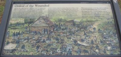
After the May 3, 1863, fighting at Chancellorsville, the Confederates gathered up 500 wounded Union soldiers and brought them here to Fairview. For more than a week the helpless men lay in the yard around the house, receiving little medical care, exposed to the wind and the rain, lying in the mud. Wounds festered and became infected. Insects attracted by piles of corpses nearby inflicted painful bites. Dozens of soldiers died; many others prayed that they might be taken too.
A team of Union surgeons arrived at Fairview on May 5. Using the door of the house as an operating table, they commenced treating wounded arms and limbs - often with amputation, an average of four per hour. Although the surgeons toiled for a week, many patients still received no attention. Finally on May 12, Union ambulances arrived under a flag of truce to carry the survivors to hospitals north of the Rappahannock.
There was no food, no nursing, and no medicine to dull the pain of those who were in torture. The majority were crowded together, had no covering tents, and many very little in the way of blankets to lie on or for cover. All were so weak they could scarcely move hand or foot.
Corporal Rice C. Bull, 123rd New York
Erected by National Park Service, U.S. Department of the Interior.
Topics. This historical marker is listed in this topic list: War, US Civil. A significant historical month for this entry is May 1863.
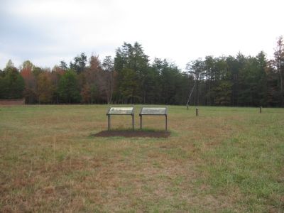
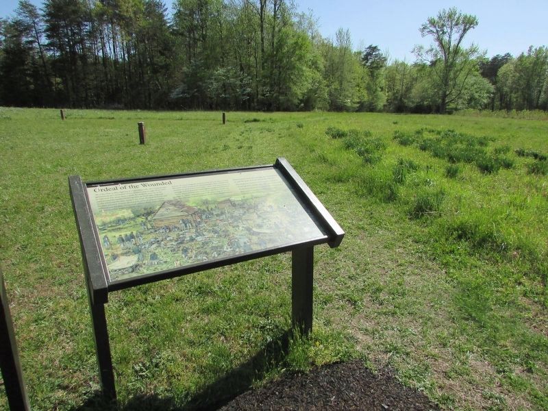
Location. 38° 18.433′ N, 77° 38.607′ W. Marker is near Spotsylvania Courthouse, Virginia, in Spotsylvania County. Marker can be reached from Berry Paxton Road, on the right when traveling east. Located at Fairview, stop ten of the driving tour of Chancellorsville Battlefield. The marker is also at stop five of the Hazel Grove-Fairview walking trail. Touch for map. Marker is in this post office area: Spotsylvania VA 22553, United States of America. Touch for directions.
Other nearby markers. At least 8 other markers are within walking distance of this marker. Fairview (here, next to this marker); Chancellor Cemetery (within shouting distance of this marker); Artillery Duel (within shouting distance of this marker); a different marker also named Fairview (within shouting distance of this marker); Jackson's Impact (within shouting distance of this marker); High Drama, Human Tragedy (within shouting distance of this marker); Collis Zouaves (approx. 0.2 miles away); The 27th Indiana Infantry (approx. 0.2 miles away). Touch for a list and map of all markers in Spotsylvania Courthouse.
More about this marker. The background of the marker is a painting of the hospital scene described on the marker.
Regarding Ordeal of the Wounded.
This is one of several markers for the Battle of Chancellorsville at Hazel Grove and Fairview, the central part of the battle. See the Hazel Grove - Fairview Virtual Tour by Markers in the links section for a listing of related markers on the tour.
Also see . . .
1. Battle of Chancellorsville. National Park Service site. (Submitted on November 18, 2007, by Craig Swain of Leesburg, Virginia.)
2. Hazel Grove - Fairview Walking Trail. A one mile walk through the scene of the heavy fighting on May 2-3, 1863. (Submitted on November 18, 2007, by Craig Swain of Leesburg, Virginia.)
3. Hazel Grove - Fairview Virtual Tour by Markers. The Hazel Grove and Fairview portions of the battlefield (stops nine and ten on the driving tour of the battlefield). Markers along this tour include those on Stuart and Slocum Drives. (Submitted on November 18, 2007, by Craig Swain of Leesburg, Virginia.)
Credits. This page was last revised on April 24, 2023. It was originally submitted on November 18, 2007, by Craig Swain of Leesburg, Virginia. This page has been viewed 1,135 times since then and 17 times this year. Photos: 1, 2. submitted on November 18, 2007, by Craig Swain of Leesburg, Virginia. 3. submitted on April 24, 2023, by Bill Coughlin of Woodland Park, New Jersey.


