Nevada City in Nevada County, California — The American West (Pacific Coastal)
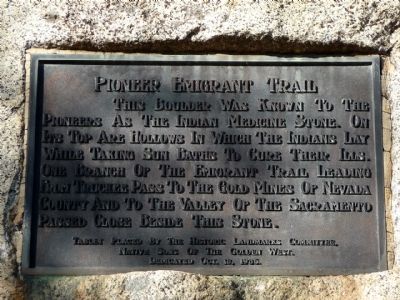
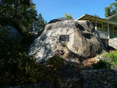
Pioneer Emigrant Trail
Native Sons of the Golden West.
Dedicated Oct. 18, 1936.
Erected 1936 by Native Sons of the Golden West.
Topics and series. This historical marker is listed in these topic lists: Native Americans • Roads & Vehicles. In addition, it is included in the California Trail, and the Native Sons/Daughters of the Golden West series lists. A significant historical year for this entry is 1936.
Location. 39° 16.02′ N, 121° 1.315′ W. Marker is in Nevada City, California, in Nevada County. Marker is on East Broad Street. Touch for map. Marker is at or near this postal address: 632 East Broad Street, Nevada City CA 95959, United States of America. Touch for directions.
Other nearby markers. At least 8 other markers are within walking distance of this marker. Pioneer Cemetery (about 700 feet away, measured in a direct line); American Hill Diggings (approx. ¼ mile away); Ten Stamp Mill (approx. ¼ mile away); Nevada City Public Library (approx. ¼ mile away); Nevada City Methodist Church (approx. ¼ mile away); Pennsylvania Engine Co. No. 2 (approx. ¼ mile away); Hydraulic Mining (approx. 0.3 miles away); Nevada County Court House (approx. 0.3 miles away). Touch for a list and map of all markers in Nevada City.
Credits. This page was last revised on June 16, 2016. It was originally submitted on October 21, 2010, by Karen Key of Sacramento, California. This page has been viewed 1,176 times since then and 45 times this year. Photos: 1, 2, 3. submitted on October 21, 2010, by Karen Key of Sacramento, California.


