Columbus in Hickman County, Kentucky — The American South (East South Central)
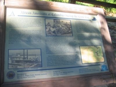
African Americans at Columbus during the Civil War

Photographed By Craig Swain, September 4, 2010
1. African Americans at Columbus during the Civil War Marker
The marker was developed by Forrest C. Pogue Public History Institute, Murray State University. It was funded by the Kentucky African American Heritage Commission. And it is administered by the Kentucky Heritage Council of the State Historic Preservation Office.
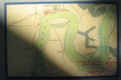
Confederate General Leonidus Polk occupied the site of Columbus and began erecting extensive fortifications in September of 1861. In addition to the soldiers under his command, more than 13,000 at one point, over 10,000 African American slaves were present. Several of those that were enslaved were personal servants of the officers, while all worked on building and maintaining earthen fortifications here at Columbus.
After the Confederate Army under Polk abandoned Columbus in March of 1862, it remained a strategically important point. The Union Army occupied Columbus establishing a major supply depot and transshippment point where troops and supplies disembarked from river boats and went south on the Mobile & Ohio Railroad, which had its terminus at Columbus. A large garrison protected the river and rail transportation links while Columbus served as District Headquarters for most of the War.
Columbus, like all Union posts in the slave states, drew in large numbers of African Americans seeking freedom. Because of its location on the Mississippi River, many came as soon as the Union troops established themselves here. Union policy was unclear about how to treat those who were known as "contrabands" and initially some were returned to their masters. This policy was unpopular with the more radical Republicans in Congress and was quickly stopped. However, sheltering them proved equally unpopular with the political leaders in Kentucky and became a point of contention between Kentucky and the Federal government.
The numbers seeking the protection of the Union Army soon overwhelmed the resources and space at Columbus, and after Polk abandoned Island 10 to the control of the Union, 1,000 former slaves were settled there in an agricultural colony. The colony was in use throughout the War and soon after African Americans were allowed to enlist, it was garrisoned by the 4th U.S. Colored Heavy Artillery.
Throughout the War, but especially in 1862 and the first few months of 1863, African Americans who had fled to the protection of the Union Army were used as casual labor by the Army. They loaded and unloaded riverboats and railroad cars here in Columbus, built fortifications, and were sent as far away as St. Louis when requested by Union commanders at posts further to the north. It is unclear from the records whether or not they were paid for their labor. When the Thirteenth Amendment was ratified ending slavery, the acting District Commander read the proclamation.
After the War ended and the military base was decommissioned, Columbus was a district office for the Freedman's Bureau. It was there that legal advice was given to former slaves, marriages were recorded, and assistance given to build churches and schools.
The history of African Americans in the Jackson Purchase is preserved and interpreted by the Warren Thomas Museum, 603 Moulton Street, Hickman, KY.
Erected by Kentucky's Civil War Heritage Trail.
Topics. This historical marker is listed in these topic lists: African Americans • War, US Civil. A significant historical month for this entry is March 1862.
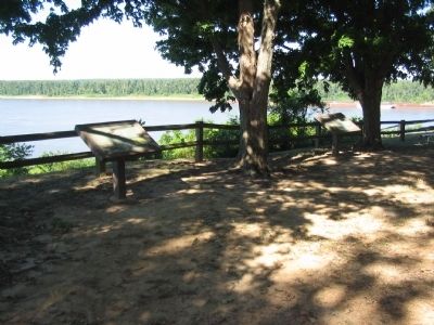
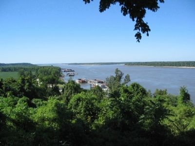
Location. 36° 45.892′ N, 89° 6.729′ W. Marker is in Columbus, Kentucky, in Hickman County. Located along the river walk in Columbus-Belmont State Park. Touch for map. Marker is in this post office area: Columbus KY 42032, United States of America. Touch for directions.
Other nearby markers. At least 8 other markers are within walking distance of this marker. Fourth United States Colored Heavy Artillery (a few steps from this marker); Earthquakes Along the Mississippi (within shouting distance of this marker); A River View of History (about 400 feet away, measured in a direct line); Columbus - A Town Transformed (about 400 feet away); "Gibraltar of the West" (about 500 feet away); The Battle at Belmont, Missouri (about 500 feet away); The History of Columbus, Kentucky (about 500 feet away); Anchor and Chain (about 600 feet away). Touch for a list and map of all markers in Columbus.
Additional keywords. USCT, United States Colored Troops
Credits. This page was last revised on October 7, 2021. It was originally submitted on October 26, 2010, by Craig Swain of Leesburg, Virginia. This page has been viewed 1,216 times since then and 22 times this year. Photos: 1, 2, 3, 4. submitted on October 26, 2010, by Craig Swain of Leesburg, Virginia.


