Manassas, Virginia — The American South (Mid-Atlantic)
The Manassas Museum
Defending the Junction
— First and Second Manassas Campaigns —
Inscription.
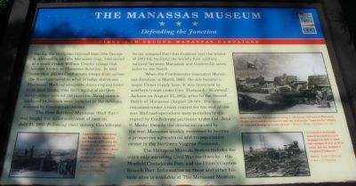
During the 1850s two railroad lines, the Orange & Alexandria and the Manassas Gap, intersected at a small Prince William County village that became known as Manassas Junction. In 1861 more than 20,000 Confederate troops from across the South gathered in what is today downtown Manassas. Working alongside slaves requisitioned from local farms, they built a ring of earthen fortifications around the junction. Naval cannon captured in Norfolk were included in the defenses, manned by Confederate sailors.
The First Battle of Manassas (Bull Run) was fought five miles northwest of here on July 21, 1861. Following their victory, Confederate forces occupied their fortifications over the winter of 1861-62, building the world’s first military railroad between Manassas and Centerville seven miles to the North.
When the Confederates evacuated Manassas Junction in March 1862, the site became a major Union supply base. It was destroyed by Southern troops under Gen. Thomas J. “Stonewall” Jackson on August 27, 1862, prior to the Second Battle of Manassas (August 28-30). The area remained under Union control for the rest of the war. Railroad operations were periodically disrupted by Confederate partisans under Col. John S. Mosby. Despite the desolation caused by the war, Manassas quickly recovered to become a prosperous agricultural and transportation center in the Northern Virginia Piedmont.
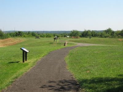
The Manassas Museum System includes the city’s only surviving Civil War earthworks—the Mayfield Confederate Fort, and the Union’s Cannon Branch Fort. Information on these and other historic sites is available at the Manassas Museum.
Erected by Civil War Trails.
Topics and series. This historical marker is listed in these topic lists: Railroads & Streetcars • War, US Civil. In addition, it is included in the Virginia Civil War Trails, and the Virginia, Wartime Manassas Walking Tour series lists. A significant historical month for this entry is March 1862.
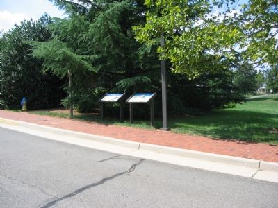
Location. This marker has been replaced by another marker nearby. It was located near 38° 44.925′ N, 77° 28.296′ W. Marker was in Manassas, Virginia. Marker could be reached from the intersection of Prince William Street and Main Street, on the right when traveling west. Located at the front of the Manassas Museum. Touch for map. Marker was at or near this postal address: 9101 Prince William Street, Manassas VA 20110, United States of America. Touch for directions.
Other nearby markers. At least 8 other markers are within walking distance of this location. Manassas (here, next to this marker); War on the Landscape (a few steps from this marker); Manassas Veterans Memorial (within shouting distance of this marker);
Wartime Manassas (about 300 feet away, measured in a direct line); Occupation or Liberation (about 300 feet away); Burning of Manassas (about 400 feet away); Manassas 1905 - The Great Fire (about 400 feet away); Liberty Street (about 400 feet away). Touch for a list and map of all markers in Manassas.
More about this marker. On the lower left, a photo of Union soldiers in one of the Manassas fortifications is captioned, “Union soldiers occupied the Manassas Junction earthworks following the Confederate evacuation in March 1862. This photograph is attributed to Mathew Brady assistant Timothy O’Sullivan.”
A drawing on the upper right is captioned, “Harper’s Weekly lithograph showing Confederate defenses at Manassas. Visible are Confederate sailors and the distinctive “soda bottle” shapes of captured Dahlgren naval cannon” - Harper’s Weekly, September 14, 1861.
The lower right has a photo of damaged railroad equipment, “Demolished buildings, ruined locomotives and widespread debris show the ravages of war at Manassas and the Northern Virginia Piedmont.”
Related markers. Click here for a list of markers that are related to this marker. To better understand the relationship, study each marker in the order shown.
Additional keywords. First Manassas Campaign, Second Manassas Campaign
Credits. This page was last revised on November 30, 2019. It was originally submitted on September 11, 2007, by Craig Swain of Leesburg, Virginia. This page has been viewed 3,567 times since then and 51 times this year. Last updated on April 7, 2011, by Jonathan Carruthers of Bealeton, Virginia. Photos: 1, 2, 3, 4. submitted on September 11, 2007, by Craig Swain of Leesburg, Virginia.


