Sunset Crater Volcano National Monument in Coconino County, Arizona — The American Mountains (Southwest)
Changes to Come
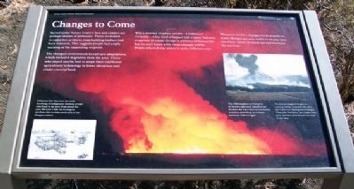
Buried under Sunset Crater's lava and cinders are perhaps dozens of pithouses. Those excavated revealed few artifacts; even building timbers had been removed. This suggests people had ample warning of the impending eruption.
The changed environment forced new adaptations, which included migration from the area. Those who stayed nearby had to adapt their traditional agricultural technology to lower elevations and cinder-covered land.
Wherever we live, changes occur around us. Some changes are only visible if we pay close attention; others demand our full attention for survival.
[Photo and illustration captions]
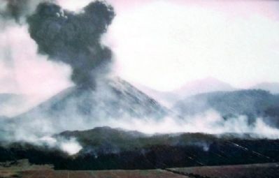
The 1943 eruption of Parícutin in Mexico (pictured above) is the modern day equivalent of the Sunset eruption, providing eyewitness accounts and analogies.
The Sunset eruption began in a 'curtain of fire' eruption, like the one in Hawaii (background image). Then, like Parícutin, the cinder cone grew and lava flowed from the base of the cone.
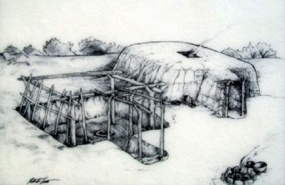
Pithouses like this were the early dwellings of indigenous farming groups who lived in the area from about the year 500 until 1300. Archeologists attribute this architectural style to the Sinagua culture.
Erected by National Park Service.
Topics. This historical marker is listed in these topic lists: Disasters • Environment • Native Americans • Settlements & Settlers. A significant historical year for this entry is 1943.
Location. 35° 21.776′ N, 111° 30.952′ W. Marker is in Sunset Crater Volcano National Monument, Arizona, in Coconino County. Marker is along the Lava Flow Trail. Touch for map. Marker is in this post office area: Flagstaff AZ 86004, United States of America. Touch for directions.
Other nearby markers. At least 8 other markers are within 12 miles of this marker, measured as the crow flies. The Power to Symbolize (within shouting distance of this marker); As Powerful as a Volcano (about 300 feet away, measured in a direct line); Life and Landscape Transformed (about 400 feet away); The Birth of a Mountain (about 500 feet away); "The Peaks" (approx. 2.3 miles away); Geological Infant (approx. 2.3 miles away); Bushmaster Park (approx. 11.3 miles away); The Museum Club (approx. 11.3 miles away). Touch for a list and map of all markers in Sunset Crater Volcano National Monument.
Also see . . . Sunset Crater Volcano National Monument. (Submitted on April 14, 2011, by William Fischer, Jr. of Scranton, Pennsylvania.)
Credits. This page was last revised on August 29, 2020. It was originally submitted on April 14, 2011, by William Fischer, Jr. of Scranton, Pennsylvania. This page has been viewed 840 times since then and 17 times this year. Photos: 1, 2, 3. submitted on April 14, 2011, by William Fischer, Jr. of Scranton, Pennsylvania.


