Downtown Detroit in Wayne County, Michigan — The American Midwest (Great Lakes)
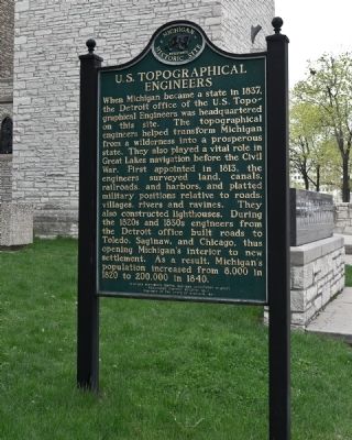
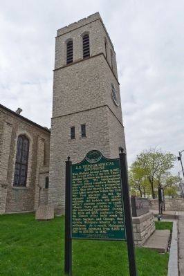
U.S. Topographical Engineers
Erected 1997 by Michigan History Division, Department of State. (Marker Number HB11.)
Topics and series. This historical marker is listed in these topic lists: Military • Roads & Vehicles • Waterways & Vessels. In addition, it is included in the Michigan Historical Commission series list. A significant historical year for this entry is 1837.
Location. 42° 19.756′ N, 83° 2.529′ W. Marker is in Detroit, Michigan, in Wayne County. It is in Downtown Detroit. Marker is at the intersection of East Jefferson Avenue (State Highway 10) and Randolph Street (State Highway 3) on East Jefferson Avenue. Touch for map. Marker is at or near this postal address: 170 East Jefferson Avenue, Detroit MI 48226, United States of America. Touch for directions.
Other nearby markers. At least 8 other markers are within walking distance of this marker. Mariners' Church / U.S. Topographical Engineers (a few steps from this marker); Shrine Circus (about 600 feet away, measured in a direct line); The Salvation Army (about 600 feet away); Spirit of Detroit (about 700 feet away); David Dunbar Buick / Buick Motor Company (about 700 feet away); Monument to Joe Louis, 1986 (about 700 feet away); The Landing of Cadillac / Le débarquement de Cadillac (approx. 0.2 miles away); University of Michigania (approx. 0.2 miles away). Touch for a list and map of all markers in Detroit.
Credits. This page was last revised on February 12, 2023. It was originally submitted on May 10, 2011, by Ronald Claiborne of College Station, Texas. This page has been viewed 645 times since then and 10 times this year. Photos: 1, 2. submitted on May 10, 2011, by Ronald Claiborne of College Station, Texas. • Bill Pfingsten was the editor who published this page.
Editor’s want-list for this marker. Photos of close view and wide view of reverse side of marker regarding "Mariner's Church". • Can you help?

