Council Grove in Morris County, Kansas — The American Midwest (Upper Plains)
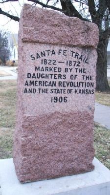
Santa Fe Trail / Council Grove
1822 - 1872
Inscription.
Marked by the
Daughters of the
American Revolution
and the State of Kansas
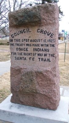
Council Grove
On this spot August 10, 1825
the treaty was made with the
Osage Indians
for the right of way of the
Santa Fe Trail
Erected 1906 by Daughters of the American Revolution and the State of Kansas.
Topics and series. This historical marker is listed in these topic lists: Fraternal or Sororal Organizations • Native Americans • Roads & Vehicles • Settlements & Settlers. In addition, it is included in the Daughters of the American Revolution, the Historic Trees, and the Santa Fe Trail series lists. A significant historical year for this entry is 1825.
Location. 38° 39.705′ N, 96° 29.056′ W. Marker is in Council Grove, Kansas, in Morris County. Marker is on Main Street (U.S. 56) near 2nd Street, on the left when traveling east. Touch for map. Marker is at or near this postal address: 106 East Main Street, Council Grove KS 66846, United States of America. Touch for directions.
Other nearby markers. At least 8 other markers are within walking distance of this marker. Council Oak (here, next to this marker); a different marker also named Council Oak (a few steps from this marker); Council Grove (a few steps from this marker); Company "C" 137th Infantry (a few steps from this marker); Bur Oak (within shouting distance of this marker); a different marker also named Bur Oak (about 400 feet away, measured in a direct line); Post Office Oak (about 600 feet away); Brewery (about 600 feet away). Touch for a list and map of all markers in Council Grove.
Also see . . .
1. Our Rich History. Council Grove Area Trade & Tourism Association website entry (Submitted on July 24, 2011, by William Fischer, Jr. of Scranton, Pennsylvania.)
2. Osage Nation. Tribe homepage (Submitted on July 24, 2011, by William Fischer, Jr. of Scranton, Pennsylvania.)
3. 8 Wonders of Kansas History: Council Grove, Santa Fe Trail National Historic Landmark. Kansas Sampler Foundation website entry (Submitted on July 24, 2011, by William Fischer, Jr. of Scranton, Pennsylvania.)
4. Santa Fe National Historic Trail. National Park Service website entry (Submitted on July 24, 2011, by William Fischer, Jr. of Scranton, Pennsylvania.)
5. Santa Fe Trail Association. Association website homepage (Submitted on July 24, 2011, by William Fischer, Jr. of Scranton, Pennsylvania.)

Photographed By William Fischer, Jr., February 19, 2011
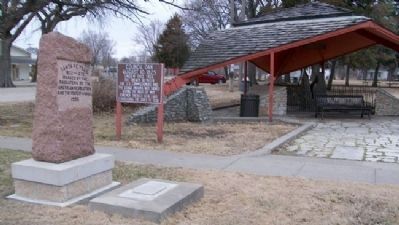
3. Santa Fe Trail / Council Grove Marker
Council Oak remnant under pavilion in background
DAR Marker Locations in Kansas:
Click for more information.
DAR Marker Locations in Kansas:
Click for more information.
Credits. This page was last revised on August 23, 2023. It was originally submitted on July 24, 2011, by William Fischer, Jr. of Scranton, Pennsylvania. This page has been viewed 498 times since then and 20 times this year. Photos: 1, 2, 3. submitted on July 24, 2011, by William Fischer, Jr. of Scranton, Pennsylvania.

