Near Ranchos de Taos in Taos County, New Mexico — The American Mountains (Southwest)
Captive Women and Children of Taos County / María Rosa Villapando, (ca. 1725-1830)
(side one)
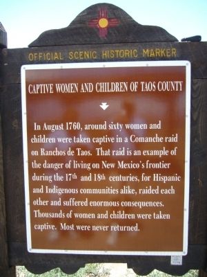
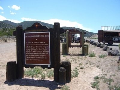
Captive Women and Children of Taos County
In August 1760, around sixty women and children were taken captive in a Comanche raid on Ranchos de Taos. That raid is an example of the danger of living on New Mexico's frontier during the 17th and 18th centuries, for Hispanic and Indigenous communities alike, raided each other and suffered enormous consequences. Thousands of women and children were taken captive. Most were never returned.
(side two)
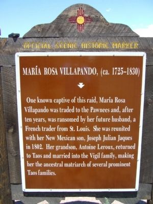
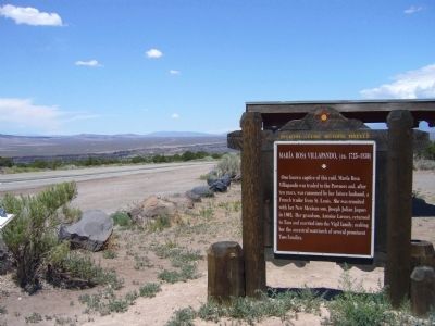
María Rosa Villapando, (ca. 1725-1830)
One known captive of this raid, María Rosa Villapando was traded to the Pawnees and, after ten years, was ransomed by her future husband, a French trader from St. Louis. She was reunited with her New Mexican son, Joseph Julian Jaques in 1802. Her grandson, Antoine Leroux, returned to Taos and married into the Vigil family, making her the ancestral matriarch of several prominent Taos families.
Erected by New Mexico Historic Preservation Division.
Topics and series. This historical marker is listed in these topic lists: Native Americans • Settlements & Settlers • Women. In addition, it is included in the New Mexico Women’s Historic Marker Initiative series list. A significant historical year for this entry is 1760.
Location. 36° 18.486′ N, 105° 43.844′ W. Marker is near Ranchos de Taos, New Mexico, in Taos County. Marker is on State Road 68 at milepost 33.6,, 4.8 miles east of State Road 570, on the right when traveling north. Touch for map. Marker is in this post office area: Ranchos de Taos NM 87557, United States of America. Touch for directions.
Other nearby markers. At least 8 other markers are within 11 miles of this marker, measured as the crow flies. William J. Klauer (within shouting distance of this marker); Pilar (approx. 4.3 miles away); Maria Ramita Simbola Martinez "Summer Harvest" (1884-1969) (approx. 7½ miles away); San Francisco de Asis Church (approx. 7.6 miles away); Pueblo of Picuris (approx. 8.2 miles away); Taos (approx. 10.3 miles away); The Harwood Museum (approx. 10.9 miles away); Kenneth Adams (approx. 10.9 miles away). Touch for a list and map of all markers in Ranchos de Taos.
Additional keywords. It is at the Taos Valley Overlook.
Credits. This page was last revised on April 26, 2020. It was originally submitted on August 6, 2011, by Bill Kirchner of Tucson, Arizona. This page has been viewed 1,693 times since then and 94 times this year. Photos: 1, 2, 3, 4. submitted on August 6, 2011, by Bill Kirchner of Tucson, Arizona. • Bernard Fisher was the editor who published this page.


