Addison in DuPage County, Illinois — The American Midwest (Great Lakes)
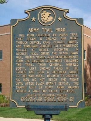
Army Trail Road
Erected 1974 by DuPage Chapter, Daughters of the American Colonists, and the Illinois State Historical Society.
Topics and series. This historical marker is listed in these topic lists: Roads & Vehicles • Wars, US Indian. In addition, it is included in the Black Hawk War, the Daughters of the American Colonists, and the Illinois State Historical Society series lists. A significant historical year for this entry is 1832.
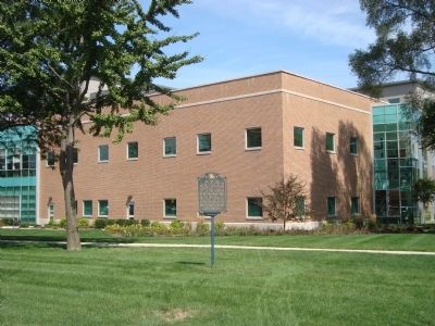
Location. 41° 55.917′ N, 87° 59.652′ W. Marker is in Addison, Illinois, in DuPage County. Marker is at the intersection of West Army Trail Boulevard and John F. Kennedy Drive on West Army Trail Boulevard. Touch for map. Marker is at or near this postal address: 211 West Army Train Boulevard, Addison IL 60101, United States of America. Touch for directions.
Other nearby markers. At least 8 other markers are within 4 miles of this marker, measured as the crow flies. Kinderheim Arch (about 600 feet away, measured in a direct line); Site of St. Paul Lutheran School (about 600 feet away); Site of Lutheran Teacher’s Seminary (about 800 feet away); The Gazebos of Addison (about 800 feet away); Veterans Circle (approx. 0.3 miles away); Old Mill (approx. one mile away); Dr. L.R. Cortesi (approx. 3.3 miles away); The Great Western Trail (approx. 3.3 miles away). Touch for a list and map of all markers in Addison.
Also see . . . The Black Hawk War of 1832. (Submitted on September 21, 2011, by Barry Swackhamer of Brentwood, California.)
Credits. This page was last revised on June 16, 2016. It was originally submitted on September 21, 2011, by Barry Swackhamer of Brentwood, California. This page has been viewed 2,568 times since then and 96 times this year. Photos: 1, 2. submitted on September 21, 2011, by Barry Swackhamer of Brentwood, California. • Bill Pfingsten was the editor who published this page.

