Greenbrier West in Chesapeake, Virginia — The American South (Mid-Atlantic)
Village of Great Bridge
A Vital Link
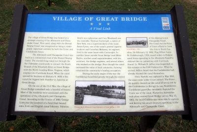
The Albemarle and Chesapeake Canal was built as a commercial rival of the Dismal Swamp Canal. The six-mile long canal cut through the flat Tidewater countryside to connect the South Branch of the Elizabeth River at Great Bridge with the North Landing River, Virginia, which empties into Currituck Sound. When the canal opened for business on January 6, 1859, it featured the biggest lock chamber in America at Great Bridge.
On the eve of the Civil War, the village of Great Bridge contained only a handful of houses. Most of the residents were associated with the operations of the Albemarle and Chesapeake Canal. According to the Census of 1860, George Lowe was the landlord of a hotel that housed some Irish and English canal laborers. Solomon Smith was a physician and Cary Woodward was the constable. Norman Cartwright, a native of New York, was a superintendent of the canal. James Lyons, one of the canal’s general superintendents and Cornelius Mahoney, its engineer, lived in the same house with Cartwright. In another house outside Great Bridge lived Miles Boyles, another canal superintendent, with his assistant, the dredge engineer, and several others who worked on the dredge. Even though the canal increased the value of local commerce, farming remained the community’s leading occupation.
During the early stages of the war the Confederacy benefitted greatly through the control of the Albemarle and Chesapeake Canal. The Canal was the focus of Union efforts to block this link to North Carolina. On February 12, 1862, Flag Officer Louis M. Goldsborough, USN, issued orders to Federal naval forces operating in the Albemarle Sound to obstruct the cut connecting with Currituck Sound. Lt. William N. Jeffers was dispatched on this mission in the USS Underwriter. When he arrived, Jeffers found that the Confederates had already blocked the canal themselves.
Once Norfolk was captured in May 1862, the canal came under Union control. The Federals quickly cleared out the canal of debris left by the Confederates to disrupt its use. Nonetheless, Confederate guerrillas constantly disputed the Union use of the canal. Numerous skirmishes took place around Great Bridge and on May 15, 1863, the local Confederates were able to capture and destroy two small steamers operating in the Albemarle and Chesapeake Canal.
(captions)
Chesapeake & Albemarle Canal entrance at Great Bridge, c. 1890.
Great Bridge, c. 1890.
Erected by Virginia Civil War Trails.
Topics and series. This historical marker is listed in these topic lists: War, US Civil • Waterways & Vessels. In addition, it is included in the Virginia Civil War Trails series list. A significant historical date for this entry is May 15, 1863.
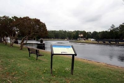
Location. This marker has been replaced by another marker nearby. It was located near 36° 43.393′ N, 76° 14.723′ W. Marker was in Chesapeake, Virginia. It was in Greenbrier West. Marker was on Locks Road, 0.3 miles west of North Battlefield Boulevard (Virginia Route 168), on the left when traveling west. Located in Great Bridge Lock Park. Touch for map. Marker was at or near this postal address: 100 Locks Rd, Chesapeake VA 23320, United States of America. Touch for directions.
Other nearby markers. At least 8 other markers are within walking distance of this location. A different marker also named Village of Great Bridge (here, next to this marker); The Battle of Great Bridge (about 400 feet away, measured in a direct line); Welcome (about 400 feet away); Bridging the Past with the Present (about 400 feet away); What is a Lock? (about 500 feet away); Why Build a Canal Here? (about 500 feet away); The Iron Titans Tame the Marsh (about 500 feet away); Liquid Highways (about 500 feet away). Touch for a list and map of all markers in Chesapeake.
Related marker. Click here for another marker that is related to this marker. New Marker At This Location also titled "Village of Great Bridge".
Also see . . .
1. Albemarle & Chesapeake Canal Historic District. National Register of Historic Places (Submitted on October 30, 2011.)
2. Site of Great Bridge Battle. National Register of Historic Places (Submitted on November 4, 2021.)
3. Great Bridge Battlefield & Waterways Foundation. (Submitted on November 4, 2021.)
Credits. This page was last revised on February 1, 2023. It was originally submitted on October 29, 2011, by Bernard Fisher of Richmond, Virginia. This page has been viewed 1,267 times since then and 27 times this year. Photos: 1, 2. submitted on October 29, 2011, by Bernard Fisher of Richmond, Virginia.

