Glasgow in Rockbridge County, Virginia — The American South (Mid-Atlantic)
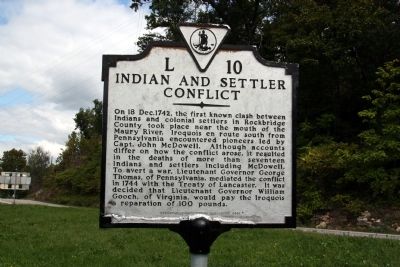
Indian and Settler Conflict
Erected 2000 by Department of Historic Resources. (Marker Number L-10.)
Topics and series. This historical marker is listed in these topic lists: Colonial Era • Native Americans • Settlements & Settlers. In addition, it is included in the Virginia Department of Historic Resources (DHR) series list. A significant historical date for this entry is December 18, 1742.
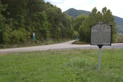
Location. 37° 37.943′ N, 79° 26.373′ W. Marker is in Glasgow, Virginia, in Rockbridge County. Marker is at the intersection of Glasgow Highway (U.S. 501) and Wert Faulkner Highway (Virginia Route 130), on the right when traveling south on Glasgow Highway . Touch for map. Marker is in this post office area: Glasgow VA 24555, United States of America. Touch for directions.
Other nearby markers. At least 8 other markers are within 6 miles of this marker, measured as the crow flies. Frank Padget (approx. 0.6 miles away); Frank Padget Water Tragedy (approx. 0.6 miles away); Amherst County / Rockbridge County (approx. 1.8 miles away); The Courage Of Frank Padget (approx. 1.8 miles away); Falling Spring Presbyterian Church (approx. 4.7 miles away); Natural Bridge (approx. 5.7 miles away); A Miracle in Stone ... Old as the Dawn (approx. 5.7 miles away); a different marker also named Natural Bridge (approx. 5.7 miles away). Touch for a list and map of all markers in Glasgow.
More about this marker. This marker replaced an earlier marker erected in the 1920s with the same number but titled “First Indian Fight” which read, “The first clash between settlers and Indians in Rockbridge County occurred near here, December 18, 1742. Captain John McDonald led the settlers; the Indians were Iroquois.”
Also see . . . Treaty of Lancaster. Wikipedia entry. “Colonial governments were unable to prevent white settlers from moving beyond the Blue Ridge and into the Shenandoah Valley in the 1730s. When the Iroquois objected, they were told that the agreed demarcation was to prevent their trespassing east of the Blue Ridge, but not to prevent the English from expanding west of them. In 1743 the Iroquois skirmished with some Valley settlers. The Iroquois were on the verge of declaring total war on the Virginia Colony when Governor Gooch paid them the sum of 100 pounds sterling for any settled land in the Valley which they claimed. The following year at the Treaty of Lancaster, the Iroquois sold all their remaining claim to the Shenandoah Valley for 200 pounds in gold.” (Submitted on November 25, 2011.)
Credits. This page was last revised on June 16, 2016. It was originally submitted on November 25, 2011, by J. J. Prats of Powell, Ohio. This page has been viewed 1,114 times since then and 65 times this year. Photos: 1, 2. submitted on November 25, 2011, by J. J. Prats of Powell, Ohio.

