Marker Logo HMdb.org THE HISTORICAL
MARKER DATABASE
“Bite-Size Bits of Local, National, and Global History”
Fort Valley in Peach County, Georgia — The American South (South Atlantic)
 

Confederate Dead


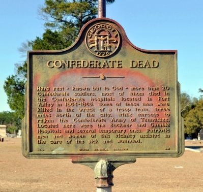
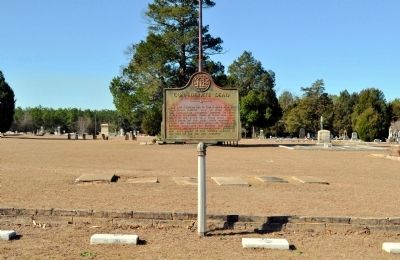
Confederate Dead Marker image. Click for full size.
Photographed By David Seibert, January 15, 2012
1. Confederate Dead Marker
Inscription. Here rest -- known but to God -- more than 20 Confederate soldiers, most of whom died in the Confederate hospitals located in Fort Valley in 1864-1865. Some of these men were killed in the wreck of a troop train, three miles north of the city, while enroute to rejoin the Confederate Army of Tennessee. Located here were the Buckner and Gamble Hospitals and several temporary ones. Patriotic men and women of this vicinity assisted in the care of the sick and wounded.
 
Erected 1956 by Georgia Historical Commission. (Marker Number 111-2.)
 
Topics and series. This historical marker is listed in these topic lists: Cemeteries & Burial SitesWar, US Civil. In addition, it is included in the Georgia Historical Society series list.
 
Location. 32° 32.761′ N, 83° 54.095′ W. Marker is in Fort Valley, Georgia, in Peach County. Marker is on South Camellia Boulevard (Georgia Route 49) near Hartley Street, on the right when traveling south. The marker is in the Confederate Cemetery section of Oaklawn Cemetery. Touch for map. Marker is in this post office area: Fort Valley GA 31030, United States of America. Touch for directions.
 
Other nearby markers. At least 8 other markers are within 10 miles of this marker, measured as the crow flies. St. Luke’s Episcopal Church (approx. half a mile away); Historically Black Colleges and Universities (HBCU) Gardens
Paid Advertisement
Click on the ad for more information.
Please report objectionable advertising to the Editor.
Click or scan to see
this page online
(approx. half a mile away); Hunt-Bond-Troup Memorial (approx. half a mile away); Peach County World War I & II Memorial (approx. 0.9 miles away); Peach County (approx. one mile away); James A. Everett (approx. one mile away); Home of Samuel Henry Rumph (approx. 6.7 miles away); Gen. John B. Gordon (approx. 9.9 miles away). Touch for a list and map of all markers in Fort Valley.
 
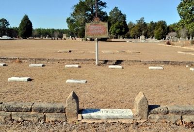
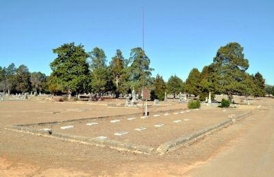
Confederate Dead Marker image. Click for full size.
Photographed By David Seibert, January 15, 2012
2. Confederate Dead Marker
Confederate Dead Marker image. Click for full size.
Photographed By David Seibert, January 15, 2012
3. Confederate Dead Marker
Confederate Dead Marker and Confederate Graves image. Click for full size.
Photographed By David Seibert, January 15, 2012
4. Confederate Dead Marker and Confederate Graves
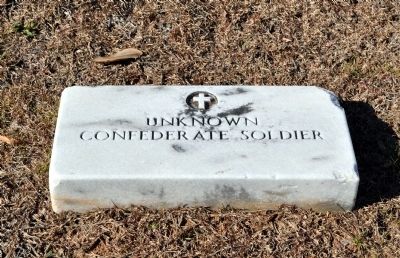
Confederate Grave Marker image. Click for full size.
Photographed By David Seibert, January 15, 2012
5. Confederate Grave Marker
 
 
Credits. This page was last revised on June 16, 2016. It was originally submitted on March 1, 2012, by David Seibert of Sandy Springs, Georgia. This page has been viewed 868 times since then and 4 times this year. Photos:   1, 2, 3, 4, 5. submitted on March 1, 2012, by David Seibert of Sandy Springs, Georgia. • Craig Swain was the editor who published this page.
Share this page.  
Share on Tumblr
m=53095

CeraNet Cloud Computing sponsors the Historical Marker Database.
This website earns income from purchases you make after using our links to Amazon.com. We appreciate your support.
Paid Advertisements
Mar. 18, 2024