Near Spotsylvania Courthouse in Spotsylvania County, Virginia — The American South (Mid-Atlantic)
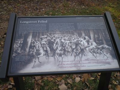
Longstreet Felled
The Battle of the Wilderness
— Fredericksburg and Spotsylvania National Military Park —

Photographed By Bill Coughlin, November 10, 2007
1. Longstreet Felled marker
This marker describes the wounding of Lt. Gen. James Longstreet on May 6, 1864, during the Battle of the Wilderness. He was shot by his own troops only a few miles from where Lt. Gen. "Stonewall" Jackson was mortally wounded, also by friendly fire.
As Longstreet galloped down the road at the head of his victorious troops – near this spot – he inadvertently rode between two Confederate lines maneuvering in the dense roadside foliage. One of them fired a volley. A bullet struck Longstreet in the throat; another killed his subordinate Micah Jenkins, riding at his side.
Like “Stonewall” Jackson a year before, Longstreet had been felled by his own men. Unlike Jackson, Longstreet would survive. But his wounding here, on May 6, stalled the Confederate advance. By the time Lee was able to revive it, the opportunity for victory had passed.
…I shall not soon forget the sadness in [General Lee’s] face, and the almost despairing movement of his hands, when he was told that Longstreet had fallen.
Captain Francis W. Dawson, Longstreet’s staff
Erected by National Park Service, U.S. Department of the Interior.
Topics. This historical marker is listed in this topic list: War, US Civil. A significant day of the year for for this entry is May 6.
Location. 38° 17.877′ N, 77° 42.877′ W. Marker is near Spotsylvania Courthouse, Virginia, in Spotsylvania County. Marker is at the intersection of Orange Plank Road (Virginia Route 621) and Wilderness Park Drive, on the right when traveling east on Orange Plank Road. Marker is in the Wilderness battlefield section of Fredericksburg and Spotsylvania National Military Park, on Orange Plank Road (Route 621), about 1/2 mile west of Brock Road (Route 613). Located at stop seven of the driving tour of the Wilderness Battlefield. Touch for map. Marker is at or near this postal address: 10925 Orange Plank Rd, Spotsylvania VA 22551, United States of America. Touch for directions.
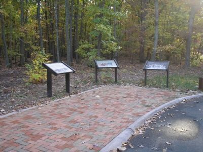
Other nearby markers. At least 8 other markers are within walking distance of this marker. Flank Attack! (here, next to this marker); Burying the Dead (here, next to this marker); James S. Wadsworth (approx. ¼ mile away); The Vermont Brigade (approx. 0.3 miles away); Hell Itself (approx. 0.3 miles away); Horror on the Orange Plank Road (approx. 0.3 miles away); Valuable Crossroads (approx. 0.3 miles away); Echoes Homeward (approx. 0.3 miles away). Touch for a list and map of all markers in Spotsylvania Courthouse.
More about this marker. In the background of the marker, This image portrays the moment of Longstreet’s wounding. Longstreet is at center; he would lose the use of his right arm for life.
Credits. This page was last revised on July 9, 2021. It was originally submitted on February 13, 2008, by Bill Coughlin of Woodland Park, New Jersey. This page has been viewed 1,981 times since then and 23 times this year. Last updated on February 14, 2008, by Bill Coughlin of Woodland Park, New Jersey. Photos: 1, 2. submitted on February 13, 2008, by Bill Coughlin of Woodland Park, New Jersey. • Craig Swain was the editor who published this page.
