Near Oriskany in Oneida County, New York — The American Northeast (Mid-Atlantic)
Alliances Drawn
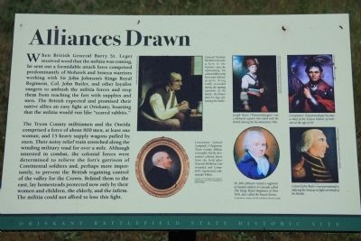
The Tryon County militiamen and the Oneida comprised a force of about 800 men, at least one woman, 15 heavy supply wagons pulled by oxen. Their noisy relief train stretched along the winding military road for over a mile. Although untested in combat, the colonial forces were determined to relieve the fort's garrison of Continental soldiers and, perhaps more importantly, to prevent the British regaining control of the valley for the Crown. Behind them to the east, lay homesteads protected now only by their women and children, the elderly, and the infirm. The militia could not afford to lose this fight.
General Nicholas Herkimer became a hero to the Patriots' cause by maintaining his calm and directing his troops' defense despite being badly wounded during the opening moments of the battle. Herkimer died 10 days following the battle.
Lieutenant Samuel Campbell, 1st Regiment, Tryon County Militia, eventually led the devastated colonial forces from the field after General Herkimer was wounded and Campbell's regimental commander killed.
Joseph Brant (Thayendanegea) was a Mohawk captain who sided with the British during the Revolutionary War
Sir John Johnson raised a regiment of loyalist soldiers in Canada called The Kings Royal Regiment of New York, also called the Royal Greens.
Cornplanter (Gayentwahga) became a chief of the Seneca Nation of Indians at the age of 18.
Colonel John Butler was instrumental in inducing the Senecas to fight on behalf of the British.
Topics. This historical marker is listed in these topic lists: Colonial Era • Native Americans • War, US Revolutionary.
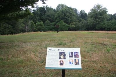
Location. 43° 10.647′ N, 75° 22.162′ W. Marker is near Oriskany, New York, in Oneida County. Marker can be reached from Rome Oriskany Road (New York State Route 69) 0.4 miles east of Monument Road. This historic marker is located at the Oriskany Battlefield State Historic Site park and can only be reached by walking. Touch for map. Marker is in this post office area: Oriskany NY 13424, United States of America. Touch for directions.
Other nearby markers. At least 8 other markers are within walking distance of this marker. A Clash of Cultures (here, next to this marker); The Rally (a few steps from this marker); In the Valley homes was great mourning (a few steps from this marker); Here the Battle of Oriskany Was Fought (within shouting distance of this marker); Relief for Fort Stanwix (within shouting distance of this marker); Welcome to Oriskany Battlefield (within shouting distance of this marker); Site of The Battle of Oriskany (within shouting distance of this marker); Near This Spot (about 500 feet away, measured in a direct line). Touch for a list and map of all markers in Oriskany.
Credits. This page was last revised on June 16, 2016. It was originally submitted on April 14, 2012, by Dale K. Benington of Toledo, Ohio. This page has been viewed 424 times since then and 17 times this year. Photos: 1, 2. submitted on April 14, 2012, by Dale K. Benington of Toledo, Ohio.

