Greenbrier West in Chesapeake, Virginia — The American South (Mid-Atlantic)
Under Two Flags
The Waterways
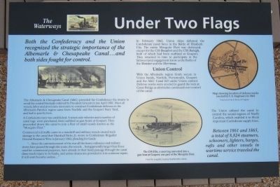
The Albemarle & Chesapeake Canal (A&C) provided the Confederacy the means to avoid the coastal blockade ordered by President Lincoln in late April 1861. Most all vessels, labor and provisions necessary to construct Confederate defenses in the Albemarle-Pamlico region came from Norfolk and the Gosport Navy Yard, and had to pass by here.
A Confederate navy was established. A steam side-wheeler and a number of canal tugs were purchased, then outfitted as gun-boats at Gosport. They proceeded down this canal to join a fleet of small vessels known as the “Mosquito Fleet.”
Commercial toll traffic came to a standstill and military vessels caused such damage to the canal that Marshall Parks, Jr. wrote to Confederate Brigadier General Benjamin Wise in January 1862, pleading for funds:
“…Since the commencement of the war all the heavy ordnance and military stores have passed through this route, the vessels…being generally larger than those used for commercial purposes, have already in their hasty passage through the canal done much injury to its banks, and unless means are provided to it in common repair, it will soon become useless…”
In February 1862, Union ships defeated the Confederate naval force in the Battle of Elizabeth City. The entire Mosquito Fleet was destroyed, except for the CSS Beaufort and the CSS Raleigh, both of which had been outfitted at Gosport. They returned in time to participate in the famous naval engagement know as the Battle of the Monitor and the Merrimac.
Union Control
With the Albemarle region firmly secure in Union hands, Norfolk, Portsmouth, Gosport and the A&C Canal fell under Union control. Defense works were erected to guard the lock at Great Bridge as skirmishes continued over control of the canal.
The Union utilized the canal to control the sound regions of North Carolina, which enabled it to block important Confederate supply lines.
Between 1861 and 1865, a total of 8,824 steamers, schooners, lighters, barges, rafts and other vessels in wartime service traveled the canal.
Erected 2012 by Great Bridge Battlefield & Waterways History Foundation.
Topics and series. This historical marker is listed in these topic lists: War, US Civil • Waterways & Vessels. In addition, it is included in the Former U.S. Presidents: #16 Abraham Lincoln series list. A significant historical month for this entry is January 1862.
Location. 36° 43.295′ N, 76° 14.427′ W. Marker is in Chesapeake, Virginia. It is in Greenbrier West. Marker can be reached from the intersection of North Battlefield Boulevard (Business Virginia Route 168) and Locks Road, on the right when traveling south. Touch for map. Marker is in this post office area: Chesapeake VA 23320, United States of America. Touch for directions.
Other nearby markers. At least 8 other markers are within walking distance of this marker. Civil War Anchor (here, next to this marker); Father & Son Canal Builders (a few steps from this marker); Site of the Original Causeway (within shouting distance of this marker); The Day is Our Own! (within shouting distance of this marker); First Fire (within shouting distance of this marker); Causeway Construction (within shouting distance of this marker); Great Bridge Marshall Memorial (about 300 feet away, measured in a direct line); Billy Flora (about 300 feet away). Touch for a list and map of all markers in Chesapeake.
More about this marker. On the left is an illustration depicting the destruction of the Gosport Navy Yard on April 29, 1861.
In the center is a sketch of "The CSS Ellis, a canal tug converted into a gun-boat at Gosport, was part of the Mosquito Fleet." From The Long Roll, Courtesy Norfolk Public Library
On the right is a "Map showing location of defense works erected by U.S. Engineers in 1862" Courtesy of the Library of Virginia
Regarding Under Two Flags. The marker's inscription has the word "odinance" in quote from the message sent to Brigadier General Wise, but the above transcription inserts "r" and removes "i" to get correct spelling "ordnance".
Also see . . . Great Bridge Battlefield & Waterways History Foundation. (Submitted on May 1, 2012, by Bernard Fisher of Richmond, Virginia.)
Credits. This page was last revised on February 1, 2023. It was originally submitted on April 29, 2012, by Bernard Fisher of Richmond, Virginia. This page has been viewed 755 times since then and 14 times this year. Last updated on December 4, 2022, by Carl Gordon Moore Jr. of North East, Maryland. Photo 1. submitted on April 29, 2012, by Bernard Fisher of Richmond, Virginia.
