Prospect in Waldo County, Maine — The American Northeast (New England)
Conflict and Prosperity on the River
Inscription.
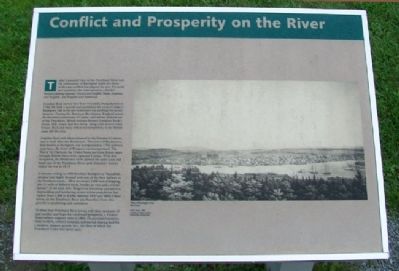
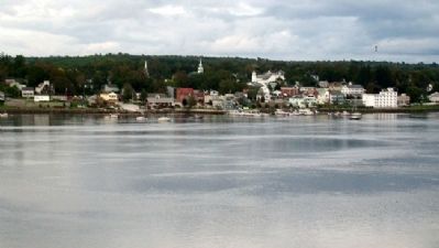
Today's peaceful view of the Penobscot River and the community of Bucksport holds few hints of the early conflicts that plagued the area. For nearly two centuries, the river served as a border between clashing interests - French and English, Native American and English, and English and American.
Jonathan Buck moved here from Haverhill, Massachusetts in 1764. He built a sawmill and established the roots of today's Bucksport. Life in the new settlement was anything but secure, however. During the American Revolution, England seized the downriver community of Castine, and claimed all lands east of the Penobscot. British soldiers burned Jonathan Buck's house, mill, vessel, and two barns, along with several other houses. Buck and many settlers not sympathetic to the British left the area.
Jonathan Buck and others returned to the Penobscot's shores and re-built after the Revolution. The town of Buckstown, later known as Bucksport, was incorporated in 1792 and two years later, the town of Prospect was incorporated. The War of 1812 between the United States and Great Britain again brought British forces who captured Castine. With this occupation, the British once more claimed the entire coast and lands east of the Penobscot River until American victory ended the war in 1815.
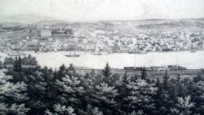
A historian writing in 1832 described Bucksport as "beautifully situated and highly favored with one of the best harbors in the Penobscot waters...Here are owned 2,000 tons of shipping, also 11 mills of different kinds, besides an iron and a woolen factory." At the same time, Bangor was becoming a prosperous shipbuilding and lumbering center whose population had tripled (from 2,868 to 8,634) between 1830 and 1840. Other towns on the Penobscot River also benefited from this growth in lumbering and commerce.
To these busy Penobscot River towns, with their memories of past conflict and hope for continued prosperity, a United States military engineer came in 1844. He purchased property, hired workers, ordered materials, and started clearing land for a modern, massive granite fort, the likes of which the Penobscot Valley had never seen.
Erected by Maine Department of Conservation.
Topics. This historical marker is listed in these topic lists: Colonial Era • Settlements & Settlers • War, US Revolutionary • Waterways & Vessels. A significant historical year for this entry is 1764.
Location. 44° 34.025′ N, 68° 48.198′ W. Marker is in Prospect, Maine, in Waldo County. Marker is about 50 feet northeast of the Fort Knox State Historic Site Visitor Center. Touch for map. Marker is at or near this postal address:
711 Fort Knox Road (Maine Route 174), Stockton Springs ME 04981, United States of America. Touch for directions.
Other nearby markers. At least 8 other markers are within walking distance of this marker. Pemtegwacook (here, next to this marker); Whitcomb-Baker VFW Post 4633 Veterans Memorial (within shouting distance of this marker); Fort Knox (about 400 feet away, measured in a direct line); A Grand Plan (about 400 feet away); A Question of Boundaries (about 400 feet away); The Architecture of Defense (about 400 feet away); Where Did the Soldiers Sleep? (about 400 feet away); The Heart of the Fort (about 400 feet away). Touch for a list and map of all markers in Prospect.
Also see . . .
1. Town of Bucksport, Maine Official Website. (Submitted on May 7, 2012, by William Fischer, Jr. of Scranton, Pennsylvania.)
2. Fort Knox State Historic Site, Maine. (Submitted on May 7, 2012, by William Fischer, Jr. of Scranton, Pennsylvania.)
Credits. This page was last revised on August 12, 2021. It was originally submitted on May 6, 2012, by William Fischer, Jr. of Scranton, Pennsylvania. This page has been viewed 567 times since then and 15 times this year. Photos: 1, 2, 3, 4. submitted on May 7, 2012, by William Fischer, Jr. of Scranton, Pennsylvania.


