Biddeford in York County, Maine — The American Northeast (New England)
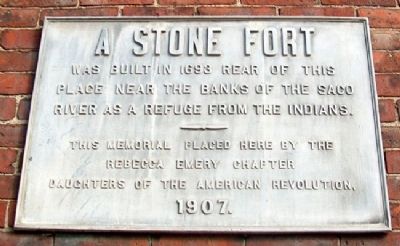
A Stone Fort
place near the banks of the Saco
River as a refuge from the Indians
Erected 1907 by Rebecca Emery Chapter, Daughters of the American Revolution.
Topics and series. This historical marker is listed in these topic lists: Colonial Era • Forts and Castles • Settlements & Settlers • War, French and Indian. In addition, it is included in the Daughters of the American Revolution series list. A significant historical year for this entry is 1693.
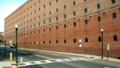
Location. 43° 29.562′ N, 70° 27.111′ W. Marker is in Biddeford, Maine, in York County. Marker is at the intersection of Main Street (Maine Route 9) and Emery Street, on the right when traveling west on Main Street. Marker is on the wall of the large former Laconia Mills building. Touch for map. Marker is at or near this postal address: 22 Main St, Biddeford ME 04005, United States of America. Touch for directions.
Other nearby markers. At least 8 other markers are within walking distance of this marker. Fort Saco in 1693 / Le Fort Saco en 1693 (here, next to this marker); Honor Roll (within shouting distance of this marker); The James Sullivan Home / Le Résidence de James Sullivan (about 400 feet away, measured in a direct line); Alfred Street / La Rue Alfred (about 400 feet away); The Laconia Co. / La Compagnie Laconia (about 400 feet away); Biddeford's La Justice / La Justice de Biddeford (about 400 feet away); Samuel Peirson's House / La Maison Samuel Peirson (about 600 feet away); The I.O.O.F. Block / Le Bloc I.O.O.F. (about 600 feet away). Touch for a list and map of all markers in Biddeford.
Also see . . . Fort Saco. (Submitted on May 27, 2012, by William Fischer, Jr. of Scranton, Pennsylvania.)
Credits. This page was last revised on November 11, 2021. It was originally submitted on May 27, 2012, by William Fischer, Jr. of Scranton, Pennsylvania. This page has been viewed 1,209 times since then and 60 times this year. Photos: 1, 2. submitted on May 27, 2012, by William Fischer, Jr. of Scranton, Pennsylvania.

