Glencarlyn in Arlington in Arlington County, Virginia — The American South (Mid-Atlantic)
Washington's Survey Marker
Inscription.
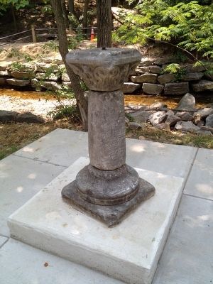
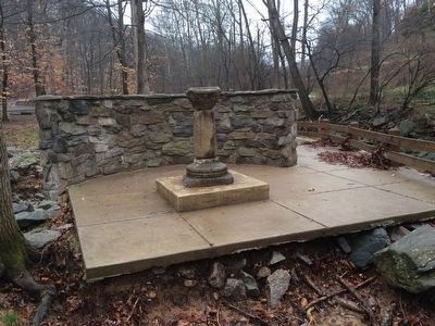
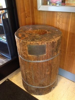
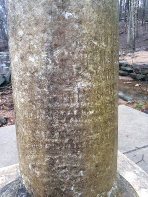
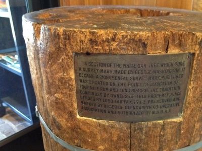
Although it is no longer legible, this monument marks the northernmost point of an approximately 1200-acre tract of land that George Washington purchased in 1775 prior to the American Revolution. Washington used an oak tree that stood on this site as a corner marker when he surveyed his property in 1785 after the war. Four Mile Run was the eastern boundary of the property. Washington owned the land at the time of his death in 1799 and afterwards it became known as “Washington’s Forest.” A section of the trunk of the oak tree that Washington used as a survey marker is on display in Glencarlyn Library.
Erected by Arlington County, Virginia.
Topics. This historical marker is listed in these topic lists: Colonial Era • Man-Made Features • Settlements & Settlers • War, US Revolutionary. A significant historical year for this entry is 1775.
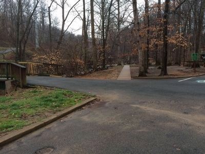
Location. Marker is missing. It was located near 38° 51.73′ N, 77° 7.03′ W. Marker was in Arlington, Virginia, in Arlington County. It was in Glencarlyn. The marker was located in Glencarlyn Park near the confluence of Long Branch and Four Mile Run. Touch for map. Marker was in this post office area: Arlington VA 22204, United States of America. Touch for directions.
Other nearby markers. At least 8 other markers are within walking distance of this location. Carlin Springs (approx. 0.4 miles away); Barcroft Community House (approx. 0.4 miles away); Enslaved Here (approx. 0.4 miles away); John Ball House (approx. 0.4 miles away); The Ball-Carlin Cemetery (approx. half a mile away); Carlin Community Hall (approx. half a mile away); Early Engagement (approx. half a mile away); Glencarlyn Station (approx. half a mile away). Touch for a list and map of all markers in Arlington.
More about this marker. The historical marker is what is missing. The survey marker—the monument—is still there. This entry uses the word “marker” with two of its meanings, therefore the text on this page—some of which is automatically generated, including the heading on this paragraph—can be confusing. First, there is the monument, which in survey work is called a survey marker, or more simply, a marker. Second, there is the missing sign, which because it relates a bit of history with its text, we call a historical marker, or more simply, a marker.
Photographed By J. Makali Bruton, March 14, 2016
4. Washington's Survey Marker
Although the monument's text is largely illegible, most of the rightmost text can be read. It appears to be very similar to the text found on the small marker attached to the portion of the tree trunk found at the Glencarlyn Library, including such words as: oak tree, made, which, survey, deeds, approved by N.S.D.A.R.
Photographed By Kevin Vincent, July 7, 2012
6. Close up of trunk showing inscription
The text reads,
A section of the white oak tree which bore a survey mark, made by George Washington. It became a monumental survey mark much used. Was located on the point at junction of Four Mile Run and Long Branch. The tradition continues by owners of this property, since deeded by Lord Fairfax, 1742. Preserved and marked by order of Glencarlyn Co-operative Association and authorized by N.S.D.A.R.
Credits. This page was last revised on October 27, 2023. It was originally submitted on June 16, 2012, by Kevin Vincent of Arlington, Virginia. This page has been viewed 2,350 times since then and 166 times this year. Photos: 1. submitted on July 7, 2012, by Kevin Vincent of Arlington, Virginia. 2, 3, 4. submitted on March 16, 2016, by J. Makali Bruton of Accra, Ghana. 5, 6. submitted on July 7, 2012, by Kevin Vincent of Arlington, Virginia. • Kevin W. was the editor who published this page.
