Cobbs Hill in Rochester in Monroe County, New York — The American Northeast (Mid-Atlantic)
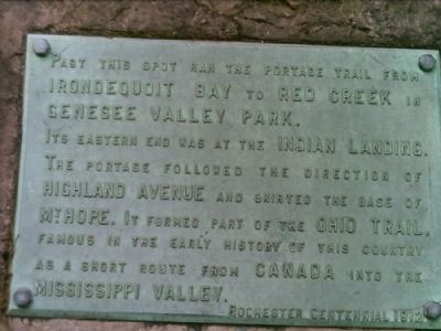
Portage Trail
Erected 1912 by Rochester Centennial.
Topics. This historical marker is listed in these topic lists: Exploration • Native Americans • Settlements & Settlers • Waterways & Vessels.
Location. 43° 8.209′ N, 77° 34.566′ W. Marker is in Rochester, New York, in Monroe County. It is in Cobbs Hill. Marker is at the intersection of Monroe Avenue and Highland Drive, on the right when traveling west on Monroe Avenue. Touch for map. Marker is in this post office area: Rochester NY 14610, United States of America. Touch for directions.
Other nearby markers. At least 8 other markers are within 2 miles of this marker, measured as the crow flies. Cobbs Hill Park / Cobbs Hill (approx. 0.3 miles away); Widewaters Field (approx. 0.3 miles away); Boyhood Home Site (approx. half a mile away); Lock 66 Neighborhood (approx. one mile away); George Eastman House (approx. 1.1 miles away); The West Garden (approx. 1.1 miles away); Brighton Village (approx. 1.2 miles away); The Children's Pavilion (approx. 1.4 miles away). Touch for a list and map of all markers in Rochester.
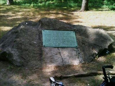
More about this marker. I indicated above that the marker is visible from the road. This is true, but you have to really look for it. The rock it's embedded in is only a foot or so high. If you are looking to visit this marker, look for the bus shelter, it's about 20-25 feet left and towards the hill behind the shelter.
Credits. This page was last revised on February 16, 2023. It was originally submitted on July 12, 2012, by Yugoboy of Rochester, New York. This page has been viewed 608 times since then and 52 times this year. Photos: 1, 2, 3. submitted on July 12, 2012, by Yugoboy of Rochester, New York. • Bill Pfingsten was the editor who published this page.


