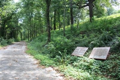
Tree Park in Chattanooga in Hamilton County, Tennessee — The American South (East South Central)
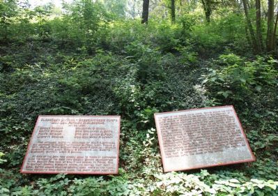
Cleburne's Division
Breckinridge's Corps.
— Maj. Gen. Patrick R. Cleburne. —
Inscription.
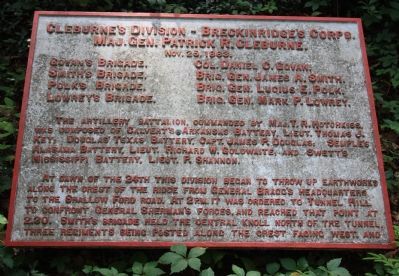
[Text from the first tablet]:
Maj. Gen. Patrick R. Cleburne.
Nov. 25, 1863.
Govan's Brigade, - Col. Daniel C. Govan.
Smith's Brigade, - Brig. Gen. James A. Smith.
Polk's Brigade, - Brig. Gen. Lucius E. Polk.
Lowrey's Brigade, - Brig. Gen. Mark P. Lowrey.
The artillery battalion, commanded by Maj. T. R. Hotchkiss, was composed of Calvert's Arkansas Battery, Lieut. Thomas J. Key, Douglas' Texas Battery, Capt. James P. Douglas, Semple's Alabama Battery, Lieut. Richard W. Goldwaite, and Swett's Mississippi Battery, Lieut. P. Shannon.
At dawn of the 24th this division began to throw up earthworks along the crest of the ridge from General Bragg's Headquarters to the Shallow Ford Road. At 2 P.M. it was ordered to Tunnel Hill to confront General Sherman's forces, and reached that point at 2:30. Smith's Brigade held the central knoll north of the tunnel, three regiments being posted along the crest facing west, and...
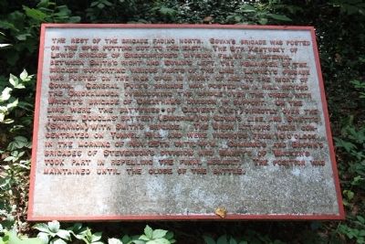
[Text from the second tablet]:
the rest of the Brigade facing north. Govan's Brigade was posted on the spur putting out to the east. The 9th Kentucky of Lewis' Brigade of Breckinridge's Division filled an interval between Smith's right and Govan's left, the remainder of the Brigade supporting various parts of the line. Lowrey's Brigade was posted on the high spur in front of and to the right of Govan. General Polk's Brigade was posted on a hill beyond the Chickamauga overlooking the bridge over the creek, with Wright's Brigade of Cheatham's Division in support. On the line were the batteries of Calvert (Key) directly over the tunnel, Douglas' Battery (Bingham) on Govan's line, and Swett's (Shannon) with Smith's Brigade. The Union attacks were concentrated on Tunnel Hill and were vigorous from 10 o'clock in the morning of Nov. 25th until 4 P.M. Cumming's and Brown's Brigades of Stevenson's Division and Maney's of Walker's took part in repelling the final assault. The position was maintained until the close of the battle.
Erected 1890 by the Chickamauga-Chattanooga National Battlefield Commission. (Marker Number MT-350-51.)
Topics and series. This historical marker is listed in this topic list: War, US Civil. In addition, it is included in the Chickamauga and Chattanooga National Military Park, Sherman Reservation, and the Chickamauga and Chattanooga National Military Park: November 25, 1863 series lists. A significant historical date for this entry is October 25, 1861.
Location. 35° 4.132′ N, 85° 14.479′ W. Marker is in Chattanooga
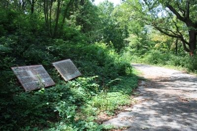
, Tennessee, in Hamilton County. It is in Tree Park. Marker is on North Crest Road north of Lightfoot Mill Road, on the right when traveling north. This historic marker is located on the western boundary of the Sherman Reservation, along the extreme northern end of North Crest Road, which is the part of that roadway that has been closed to vehicle traffic by the National Park Service, on the eastern side of that roadway. Touch for map. Marker is in this post office area: Chattanooga TN 37404, United States of America. Touch for directions.
Other nearby markers. At least 8 other markers are within walking distance of this marker. 10th U.S. Missouri Infantry (here, next to this marker); Matthies' Brigade (within shouting distance of this marker); Buschbeck's Brigade (within shouting distance of this marker); 26th U.S. Missouri Infantry (within shouting distance of this marker); Calvert's Arkansas Battery (within shouting distance of this marker); Union Casualties (within shouting distance of this marker); Confederate Casualties (within shouting distance of this marker); 93rd Illinois Infantry (about 300 feet away, measured in a direct line). Touch for a list and map of all markers in Chattanooga.
More about this marker. Because of its location in the Sherman Reservation it cannot be reached by car and can only be reached by foot. I would suggest parking your car in the provided parking area on Lightfoot Mill Road and then walking north on North
Crest Road. You will reach a spot on this road where there is a locked gate barring further vehicle traffic on the road, but not foot traffic. Continue to walk north on the North Crest Road extension and after a short walk (maybe about a tenth of a mile) you will notice this historic marker on your right.
Credits. This page was last revised on February 7, 2023. It was originally submitted on August 11, 2012, by Dale K. Benington of Toledo, Ohio. This page has been viewed 577 times since then and 8 times this year. Photos: 1, 2, 3, 4, 5. submitted on August 12, 2012, by Dale K. Benington of Toledo, Ohio.
