Clayton in Contra Costa County, California — The American West (Pacific Coastal)
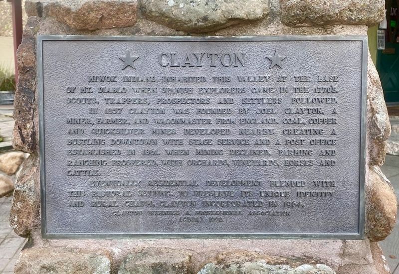
Clayton
In 1857 Clayton was founded by Joel Clayton, a miner, farmer, and wagonmaster from England. Coal, copper and quicksilver mines developed nearby, creating a bustling downtown with stage service and a post office established in 1861. When mining declined, farming and ranching prospered, with orchards, vineyards, horses and cattle.
Eventually residential development blended with this historical setting. To preserve its unique identity and rural charm, Clayton incorporated in 1964.
Erected 1992 by Clayton Business & Professional Association (CBPA).
Topics. This historical marker is listed in these topic lists: Agriculture • Exploration • Native Americans • Natural Resources • Settlements & Settlers. A significant historical year for this entry is 1857.
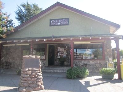
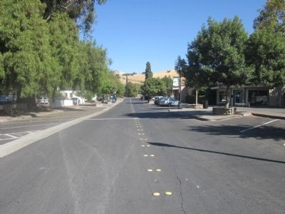
Location. 37° 56.472′ N, 121° 56.15′ W. Marker is in Clayton, California, in Contra Costa County. Marker is at the intersection of Main Street and Diablo Street, on the right when traveling east on Main Street. Touch for map. Marker is in this post office area: Clayton CA 94517, United States of America. Touch for directions.
Other nearby markers. At least 8 other markers are within walking distance of this marker. Clayton Cash Store (within shouting distance of this marker); The Clayton Club (within shouting distance of this marker); Clayton Veterans Memorial (within shouting distance of this marker); Clayton Museum Educational Garden (about 300 feet away, measured in a direct line); Farming & Ranching in Clayton (about 300 feet away); Joaquin Murrieta (about 300 feet away); The Joel Clayton House (about 300 feet away); Endeavor Hall (about 400 feet away). Touch for a list and map of all markers in Clayton.
Additional commentary.
1. Clayton Becomes the Thirteenth City in Contra Costa County - 1964
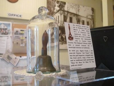
An election was held in Endeavor Hall on March 3, 1964, when 91% of Clayton’s 364 registered voters balloted, 251 to 61, to make Clayton the thirteenth city in Contra Costa County. The Oakland Tribune called this a record turnout for a municipal election in California.
At 8:00 p.m. Sigrid Frank, a 69 year-old Clayton “old-timer” who was the poll inspector, stepped onto the front porch, rang a brass bell, and in traditional style proclaimed: “Hear ye! Hear ye! Hear ye! The polls are closed.”
Source: Clayton Museum
— Submitted October 1, 2012.
Credits. This page was last revised on January 13, 2022. It was originally submitted on October 1, 2012, by Syd Whittle of Mesa, Arizona. This page has been viewed 743 times since then and 40 times this year. Photos: 1. submitted on January 13, 2022. 2, 3, 4, 5. submitted on October 1, 2012, by Syd Whittle of Mesa, Arizona.
