New Germany Lake
New Germany State Park
— Friends of New Germany —
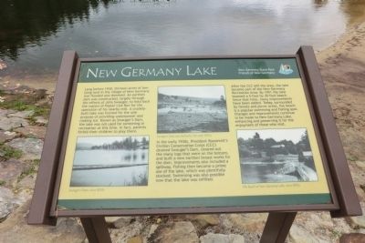
Long before 1930, thirteen acres of low-lying land in the village of New Germany was flooded and dammed. An earthen dam was constructed, largely through the efforts of John Swauger, to hold back the waters of Poplar Lick Run for the operation of his nearby mill. A crudely-built lake was formed for the sole purpose of providing waterpower and making ice. Known as Swauger’s Dam, the lake was not used for swimming or recreation at this time. In fact, parents forbid their children to play there.
In the early 1930’s President Roosevelt’s Civilian Conservation Corps (CCC) drained Swaugers’s Dam, cleared out the many logs that were on the bottom, and built a new earthen breast works for the dam. Improvements also included a spillway. Fishing then became a prime use of the lake, which was plentifully stocked. Swimming was also possible now that the lake was refilled.
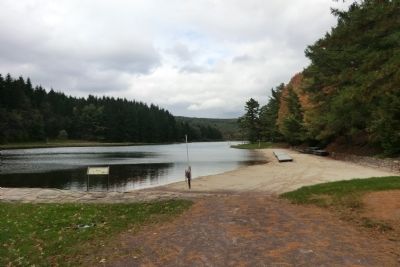
After the CCC left the area, the lake became part of the New Germany Recreation Area. By 1951 the lake boasted a 5-foot by 30-foot beach. Since that time, many improvements have been added. Today, surrounded by forests and picnic areas, the beach is a popular swimming and fishing spot. Changes and improvements continue to be made to New Germany Lake, enhancing and preserving it for the enjoyment of those who visit.
Topics and series.
Location. 39° 37.962′ N, 79° 7.326′ W. Marker is in Grantsville, Maryland, in Garrett County. Marker is on McAndrews Hill Road. Touch for map. Marker is in this post office area: Grantsville MD 21536, United States of America. Touch for directions.
Other nearby markers. At least 8 other markers are within 5 miles of this marker, measured as the crow flies. Swauger Mill (within shouting distance of this marker); Robert Lee Payne (approx. 2.2 miles away); Little Meadows (approx. 4.3 miles away); Crash of a United States B-52 Bomber (approx. 4˝ miles away); Stanton’s Mill (approx. 4˝ miles away); Bear Hill School (approx. 4˝ miles away); Yoder House (approx. 4˝ miles away); Markley House (approx. 4˝ miles away). Touch for a list and map of all markers in Grantsville.
Credits. This page was last revised on September 28, 2020. It was originally submitted on November 17, 2012, by Don Morfe of Baltimore, Maryland. This page has been viewed 680 times since then and 52 times this year. Photos: 1, 2, 3, 4. submitted on November 17, 2012, by Don Morfe of Baltimore, Maryland. • Bill Pfingsten was the editor who published this page.


