Wayne in Passaic County, New Jersey — The American Northeast (Mid-Atlantic)
Wayne Township
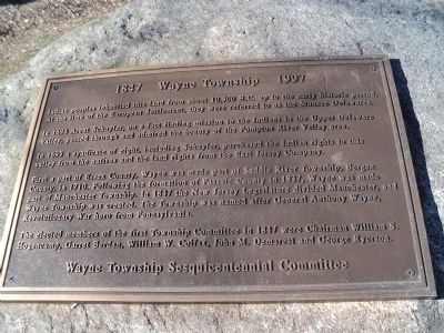
1847 1997
Indian peoples inhabited this land from about 10,500 B.C. up to the early historic period. At the time of the European Settlement, they were referred to as the Munsee Delawares.
In 1694 Arent Schuyler, on a fact finding mission to the Indians in the Upper Delaware Valley, passed through and admired the beauty of the Pompton River Valley area.
In 1695 a syndicate of eight, including Schuyler, purchased the Indian rights to this valley from the natives and the land rights from the East Jersey Company.
First a part of Essex County, Wayne was made part of Saddle River Township, Bergen County, in 1710. Following the formation of Passaic County in 1837, Wayne was made part of Manchester Township. In 1847 the New Jersey Legislature divided Manchester, and Wayne Township was created. The Township was named after General Anthony Wayne, Revolutionary War hero from Pennsylvania.
The elected members of the first Township Committee in 1847 were Chairman William S. Hogencamp, Garret Berdan, William W. Colfax, John M. Demarest and George Ryerson.
Erected by Wayne Township Sesquicentennial Committee.
Topics. This historical marker is listed in these topic lists: Colonial Era • Native Americans • Settlements & Settlers. A significant historical year for this entry is 1694.
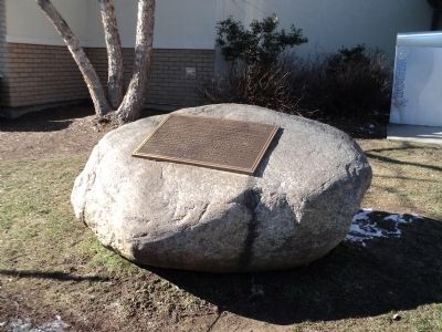
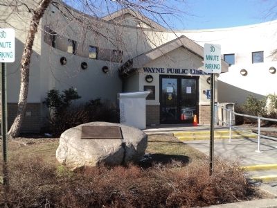
Location. 40° 55.7′ N, 74° 13.88′ W. Marker is in Wayne, New Jersey, in Passaic County. Marker is at the intersection of Valley Road and Nellis Drive, on the right when traveling south on Valley Road. Marker is located in front of the Wayne Public Library. Touch for map. Marker is at or near this postal address: 461 Valley Road, Wayne NJ 07470, United States of America. Touch for directions.
Other nearby markers. At least 8 other markers are within 2 miles of this marker, measured as the crow flies. Kipp – Nellis Farm (here, next to this marker); Samuel Van Saun House (approx. half a mile away); Van Saun House (approx. half a mile away); The Dey Mansion (approx. 0.9 miles away); Colonel Theunis Dey (approx. 0.9 miles away); Washington Headquarters (approx. 0.9 miles away); Vietnam Era Veterans Memorial (approx. 1.8 miles away); 9-11 Memorial (approx. 1.9 miles away). Touch for a list and map of all markers in Wayne.
Credits. This page was last revised on June 16, 2016. It was originally submitted on January 27, 2013, by Bill Coughlin of Woodland Park, New Jersey. This page has been viewed 503 times since then and 16 times this year. Photos: 1, 2, 3. submitted on January 27, 2013, by Bill Coughlin of Woodland Park, New Jersey.


