Near Oakland in Garrett County, Maryland — The American Northeast (Mid-Atlantic)
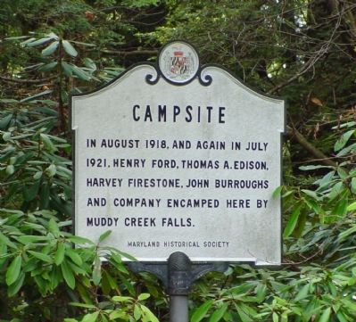
Campsite
Erected by Maryland Historical Society.
Topics. This historical marker is listed in these topic lists: Industry & Commerce • Waterways & Vessels. A significant historical month for this entry is July 1921.
Location. 39° 30.044′ N, 79° 25.028′ W. Marker is near Oakland, Maryland, in Garrett County. Marker can be reached from Swallow Falls Road west of Oakland-Sang Run Road. Marker is in Swallow Falls State Park, near the top of the Muddy Creek Falls. Touch for map. Marker is in this post office area: Oakland MD 21550, United States of America. Touch for directions.
Other nearby markers. At least 5 other markers are within 5 miles of this marker, measured as the crow flies. Youghiogheny Grove (about 700 feet away, measured in a direct line); Civilian Conservation Corps (about 700 feet away); Swallow Falls vs. Hurricane Sandy (about 700 feet away); Forestry Beginning (approx. 3˝ miles away); Deep Creek Lake (approx. 4.6 miles away). Touch for a list and map of all markers in Oakland.
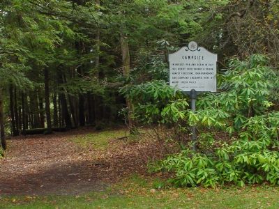
More about this marker. The marker, and the falls, are a short walk through an old-growth hemlock and pine evergreen forest from the parking lot. There is a $3 per-car parking fee.
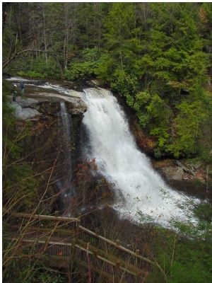
Regarding Campsite. Swallow Falls State Park rents campsites in the forest, but not next to the falls. There are hiking trails, a picnic area, and an open stone pavilion with a fireplace. The creek bed is carved through the bedrock and Muddy Creek has no mud here. Downstream from Muddy Creek Falls is the smaller Swallow Falls, at the bottom of which are various wading and swimming pools carved in the rock, and plenty of smooth rock to sun oneself on. But the crystal-clear mountain-stream water is always cold!
Credits. This page was last revised on November 22, 2019. It was originally submitted on October 19, 2006, by J. J. Prats of Powell, Ohio. This page has been viewed 2,419 times since then and 55 times this year. Photos: 1, 2, 3. submitted on October 19, 2006, by J. J. Prats of Powell, Ohio.


