Snow Hill in Greene County, North Carolina — The American South (South Atlantic)
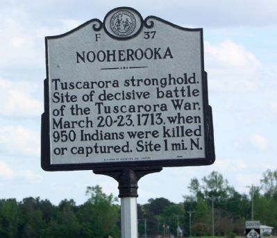
Nooherooka
Tuscarora stronghold. Site of decisive battle of the Tuscarora War, March 20-23, 1713, when 950 Indians were killed or captured. Site 1 mi. N.
Erected 1994 by Division of Archives and History. (Marker Number F-37.)
Topics and series. This historical marker is listed in these topic lists: Native Americans • Wars, US Indian. In addition, it is included in the North Carolina Division of Archives and History series list. A significant historical date for this entry is March 20, 1713.
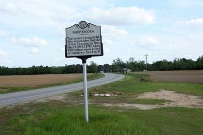
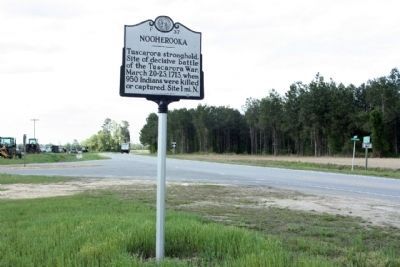
Location. 35° 28.609′ N, 77° 43.68′ W. Marker is in Snow Hill, North Carolina, in Greene County. Marker is at the intersection of North Carolina Highway 58 (State Highway 58) and Fort Run Road (State Highway 1058), on the right when traveling south on North Carolina Highway 58. Touch for map. Marker is at or near this postal address: 1661 North Carolina Hwy 58, Snow Hill NC 28580, United States of America. Touch for directions.
Other nearby markers. At least 8 other markers are within 10 miles of this marker, measured as the crow flies. James Glasgow (approx. 1.9 miles away); Snow Hill (approx. 3.6 miles away); Tuscarora War (approx. 3.6 miles away); Grimsley Baptist Church (approx. 5 miles away); Hull Road (approx. 5 miles away); Peacock's Bridge (approx. 8.9 miles away); Nuclear Mishap (approx. 9½ miles away); Wheat Swamp Church (approx. 9.9 miles away). Touch for a list and map of all markers in Snow Hill.
Regarding Nooherooka. European colonists encroached on Native American land as the colony of North Carolina grew; consequently tensions escalated between the two groups. In 1711, the Tuscarora, who controlled most of the land between the Neuse and Roanoke Rivers, began a war with the colonists. In September of that year, the Tuscarora captured and killed John Lawson, whom they believed was the governor. Lawson’s capture signaled the beginning of a three-day rampage that left at least 120 colonists dead in Bath and the surrounding countryside. Men, women and children were killed and their bodies mutilated throughout the region. Houses, stock, and barns were destroyed.
Colonial leaders failed to formulate a strategy for protection and, instead, sent pleas for assistance to
Virginia and South Carolina. In response, South Carolina sent Colonel John Barnwell fortified with white militia and a large army of Native American allies from the Yamassee tribe that were hostile to the Tuscarora. Upon his arrival in January, 1712, Barnwell expected reinforcements from North Carolina but received little assistance. Barnwell first attacked Torhunta, a network of farms in modern Wayne County. He destroyed all of the forts and villages in the region before leaving the area.
Barnwell continued his trek through North Carolina in efforts to put an end to Tuscarora strength and
opposition. His next target was another palisade fort at Catechna where he encountered much resistance. Barnwell was forced to call a truce and drew back to construct his own fort nearby to force a peace. Barnwell left the colony in disarray later in 1712 and Native Americans continued to attack colonists.
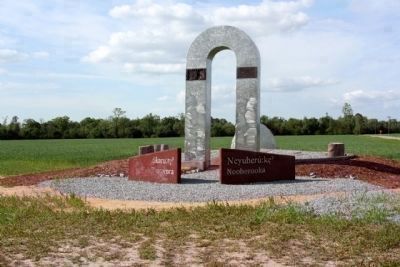
North Carolina again appealed to South Carolina and another force under the command of Colonel James Moore entered the colony. Moore marched his combined force of North and South Carolina militia and allied Native Americans to Nooherooka. Moore had been informed that the Tuscarora had placed its largest concentration of warriors at the well constructed fort on a branch of Contentea Creek in modern Greene County. Archaeological investigations of the fort have revealed a series of interconnected bunkers and tunnels supplied by large quantities of food and supplies. The fort covered 1 ½ acres and had high palisades.
Moore laid siege to the fort in March 1713 and defeated the warriors by mining an outer wall and
setting fire to the fort and its structures. It took Moore’s
men three days after the fall of the first wall before the fort was completely overtaken. By that time, 392 Tuscarora were burned or killed inside the fort and another 558 were either killed or captured. The fall of Nooherooka signaled the end of concerted Native American resistance to colonists and, all told, by the end of the Tuscarora War, approximately 200 whites and 1,000 natives were killed with about 1,000 Tuscarora sold into slavery and over 3000 forced from their homes, many eventually migrating northward to Pennsylvania and New York. With the threat of violence from hostile Native Americans removed, white colonists flooded into the backcountry and extended the frontier farther west. (North Carolina Office of Archives & History — Department of Cultural Resources)
Also see . . .
1. Fort Neoheroka. Wikipedia entry (Submitted on April 17, 2024, by Larry Gertner of New York, New York.)
2. Tuscarora War. North Carolina History Project website entry:
... North Carolinians and the Yamasee waged war against the Tuscarora. Many colonists’ settlements were burned and the Tuscarora ax indiscriminately fell upon men, women, and children. In the end, English colonists prevailed. Captured Tuscarora were sold into slavery and those that escaped northward joined the Iroquois League. ... (Submitted on May 2, 2013, by Mike Stroud of Bluffton, South Carolina.)
Credits. This page was last revised on April 17, 2024. It was originally submitted on May 1, 2013, by Mike Stroud of Bluffton, South Carolina. This page has been viewed 1,193 times since then and 77 times this year. Last updated on May 7, 2023, by Michael Buckner of Durham, North Carolina. Photos: 1, 2, 3, 4. submitted on May 2, 2013, by Mike Stroud of Bluffton, South Carolina. • J. Makali Bruton was the editor who published this page.


