Salina in Saline County, Kansas — The American Midwest (Upper Plains)
Founders Park
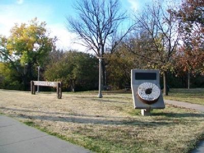
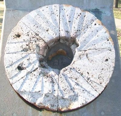
In early February, 1858, Colonel William A. Phillips, Alexander M. Campbell, and James Muir, seeking a location for a townsite, explored the banks of the Smoky Hill River. They drove the stakes to found Salina in this immediate area. This park commemorates that event. The milling industry played a significant role in the growth of Salina. This millstone is believed to be the original stone from Phillips Mill, the first steam-powered grist mill in Salina, opened in May, 1861.
July 4, 1976
Erected 1976.
Topics. This historical marker is listed in these topic lists: Agriculture • Industry & Commerce • Parks & Recreational Areas • Settlements & Settlers. A significant historical year for this entry is 1858.
Location. 38° 50.442′ N, 97° 36.377′ W. Marker is in Salina, Kansas, in Saline County. Marker is on Iron Avenue, on the left when traveling east. Touch for map. Marker is at or near this postal address: 303 East Iron Avenue, Salina KS 67401, United States of America. Touch for directions.
Other nearby markers. At least 8 other markers are within walking distance of this marker. Site of First Free Ferry on Smoky Hill River (within shouting distance of this marker); The Founders of the Salina Town Company (approx. 0.2 miles away); Fox-Watson Theatre (approx. 0.2 miles away); August Bondi (approx. ¼ mile away); Gen. John A. Logan (approx. 0.4 miles away); Oakdale Memorial Gateway (approx. 0.4 miles away); Col. William A. Phillips (approx. 0.4 miles away); Replica of the Statue of Liberty (approx. 0.4 miles away). Touch for a list and map of all markers in Salina.
Also see . . .
1. History of Salina, Kansas. City website entry (Submitted on May 4, 2013, by William Fischer, Jr. of Scranton, Pennsylvania.)
2. Smoky Hill Museum, Salina KS. (Submitted on May 4, 2013, by William Fischer, Jr. of Scranton, Pennsylvania.)
Credits. This page was last revised on February 2, 2022. It was originally submitted on May 4, 2013, by William Fischer, Jr. of Scranton, Pennsylvania. This page has been viewed 887 times since then and 34 times this year. Photos: 1, 2, 3. submitted on May 4, 2013, by William Fischer, Jr. of Scranton, Pennsylvania.


