Innenstadt in Innsbruck, Tyrol, Austria — Central Europe (Eastern Alps)
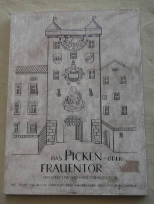
The Pecking- or Women’s Gate
Das Picken- oder Frauentor
Errichtet um 1340 – Abgetragen 1779
Der Stadt Innsbruck gewidmet vom Innsbrucker Verschönerungsverein
German-English translation:
Built in 1340 – Demolished in 1779
Dedicated to the City of Innsbruck by the Innsbruck Beautification Society
Erected by Innsbrucker-Verschönerungsverein (Innsbruck Beautification Society).
Topics. This historical marker is listed in these topic lists: Forts and Castles • Women. A significant historical year for this entry is 1340.
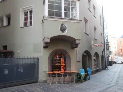
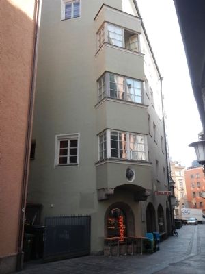
Location. 47° 16.059′ N, 11° 23.504′ E. Marker is in Innenstadt, Tirol (Tyrol), in Innsbruck. Marker is at the intersection of Seilergasse and Schlossergasse, on the right when traveling west on Seilergasse. Touch for map. Marker is at or near this postal address: Seilergasse 16, Innenstadt, Tirol 6020, Austria. Touch for directions.
Other nearby markers. At least 8 other markers are within walking distance of this marker. The Old Town Armory/Barracks (within shouting distance of this marker); Gumpp House (within shouting distance of this marker); "Ottoburg" Castle (about 90 meters away, measured in a direct line); Kolb Tower (about 90 meters away); "Golden Eagle" (about 90 meters away); Goethe Stayed Here (about 120 meters away); The Speech (about 120 meters away); Old Government Building (about 120 meters away). Touch for a list and map of all markers in Innenstadt.

Photographed By Barry Swackhamer, July 14, 2013
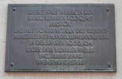
4. Additional plaque on Das Picken-oder Frauentor
Kriegsjähren 1939/45
Zerstört
Und äus Fonds mitteln des Bundes-
Minsteriums F. Händel U. Wiederäufbäu
In den jähren 1953/54
Unter dem Bundeskänzler
Ing. Julius Rääb
Wiederhergestellt
German-English translation:
This building was destroyed during the war years, 1939-1945, and was rebuilt 1953-1954 with funding from the Federal Ministry of Commerce and Reconstruction under Chancellor Julius Rääb.
Credits. This page was last revised on February 1, 2022. It was originally submitted on August 28, 2013, by Barry Swackhamer of Brentwood, California. This page has been viewed 724 times since then and 37 times this year. Photos: 1, 2, 3, 4. submitted on August 28, 2013, by Barry Swackhamer of Brentwood, California. • Andrew Ruppenstein was the editor who published this page.


