Near Tuolumne in Tuolumne County, California — The American West (Pacific Coastal)
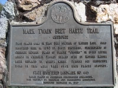
Cherokee
— Mark Twain Bret Harte Trail —
Erected 1949 by California Centennial Commission with base provided by Tuolumne City Progressive Association. (Marker Number 445.)
Topics and series. This historical marker is listed in these topic lists: Native Americans • Natural Resources • Notable Events • Settlements & Settlers. In addition, it is included in the California Historical Landmarks, and the Mark Twain Bret Harte Trail series lists. A significant historical year for this entry is 1853.
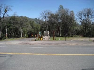
Location. 37° 58.791′ N, 120° 14.883′ W. Marker is near Tuolumne, California, in Tuolumne County. Marker is on Confidence-Tuolumne City Road (County Route E17) 0.1 miles north of Cherokee Rd., on the right when traveling north. Touch for map. Marker is at or near this postal address: 19721 Tuolumne Rd N, Tuolumne CA 95379, United States of America. Touch for directions.
Other nearby markers. At least 8 other markers are within 2 miles of this marker, measured as the crow flies. Soulsbyville (approx. 0.9 miles away); a different marker also named Soulsbyville (approx. 0.9 miles away); The Joseph Lord House (approx. one mile away); Westside Flume & Lumber Company (approx. 1.1 miles away); Hose Cart House (approx. 1.1 miles away); Tuolumne (formerly called Summersville) (approx. 1.3 miles away); West Side Memorial Park (approx. 1.4 miles away); Tuolumne Memorial Hall (approx. 1.4 miles away). Touch for a list and map of all markers in Tuolumne.
Credits. This page was last revised on June 16, 2016. It was originally submitted on April 1, 2008, by Richard Wisehart of Sonora, California. This page has been viewed 1,640 times since then and 44 times this year. Photos: 1, 2. submitted on April 1, 2008, by Richard Wisehart of Sonora, California. • Kevin W. was the editor who published this page.

