Cerrillos in Santa Fe County, New Mexico — The American Mountains (Southwest)
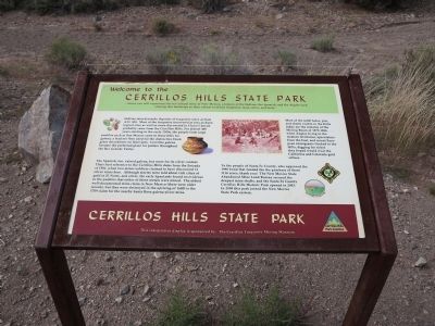
Welcome to the Cerrillos Hills State Park
Inscription.
… where you will experience the tri-cultural story of New Mexico, a history of the Indians, the Spanish, and the Anglos each altering this landscape in their efforts to obtain turquoise, lead, silver, and more.
Indians mined nearby deposits of turquoise since at least A.D. 900. Most of the turquoise uncovered at area archaeological sites as well as some discovered in Chaco Canyon probably came from the Cerrillos Hills. For almost 400 years starting in the early 1300s, the people from large pueblos such as San Marcos came to these hills for galena, a lead ore they used for the detective black glaze decorations on their pots. Cerrillos galena became the preferred glaze for potters throughout the Rio Grande Valley.
The Spanish, too, valued galena, but more for its silver content. Their first reference to the Cerrillos Hills dates from the Entrada of 1581, when two miner-soldiers claim to have discovered 11 silver veins here. Although stories were told about rich cities of gold in El Norte, and silver, the early Spaniards found no evidence in the pueblos that either of these metals were mined. The oldest well-documented mine claim in New Mexico (there were older records, but they were destroyed in the uprising of 1680) is the 1709 claim for the nearby Santa Rosa galena-silver mine.
Most of the 4,000 holes, pits, and shafts visible in the Hills today are the remains of the Mining Book of 1879-1884, when Anglos living in the western territories, speculators from the East, and recent European immigrants flocked to the Hills, digging for riches they hoped would rival the California and Colorado gold strikes.
To the people of Santa Fe County, who approved the 1998 bond that funded the purchase of these 1116 acres, thank you! The New Mexico State Abandoned Mine Land Bureau secured the deepest mine shafts, and the Santa Fe County Cerrillos Hills Historic Park opened in 2003. In 2009 this park joined the New Mexico State Park system.
Erected by The Cerrillos Turquoise Mining Museum.
Topics. This historical marker is listed in these topic lists: Exploration • Hispanic Americans • Industry & Commerce • Native Americans. A significant historical year for this entry is 1581.
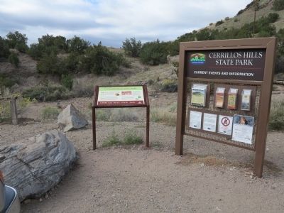
Location. 35° 26.68′ N, 106° 7.354′ W. Marker is in Cerrillos, New Mexico, in Santa Fe County. Marker is on County Road 59, on the right when traveling south. Marker is located in a parking area. Touch for map. Marker is at or near this postal address: 80 County Road 89, Cerrillos NM 87010, United States of America. Touch for directions.
Other nearby markers. At least 8 other markers are within walking distance of this marker. Welcome to Cerrillos (approx. half a mile away); Briggs Building
(approx. half a mile away); Cerrillos through the Years (approx. half a mile away); The Cerrillos Bar (approx. half a mile away); DeLallo-Simoni-Torres Building (approx. 0.6 miles away); The Simoni Store (approx. 0.6 miles away); R. Granito's General Store (approx. 0.6 miles away); The Joe M. Granito Block (approx. 0.6 miles away).
Also see . . .
1. Cerrillos Hills State Park Website. Park headquarters are actually located in Cerrillos at 37 Main Street, not in the park's mining district itself. (Submitted on December 3, 2013, by Richard Denney of Austin, Texas.)
2. Mt. Chalchihuitl. New Mexico History Org article on Mt. Chalchihuitl, the oldest and most famous of Cerrillos Hill's mines. Mt. Chalcihuitl is currently not included in the State Park, but efforts are underway to secure it. (Submitted on December 3, 2013, by Richard Denney of Austin, Texas.)
3. Tri-Cultural Use of the Cerrillos Mines. Article from Amigos de Cerrillos Hills State Park website. The "Entrada of 1581" referenced on the marker is the Rodriguez-Chamuscado Entrada (Expedition) of 1581. (Submitted on December 3, 2013, by Richard Denney of Austin, Texas.)
Credits. This page was last revised on June 16, 2016. It was originally submitted on December 3, 2013, by Richard Denney of Austin, Texas. This page has been viewed 692 times since then and 14 times this year. Photos: 1, 2. submitted on December 3, 2013, by Richard Denney of Austin, Texas. • Syd Whittle was the editor who published this page.

