Near Fairfax in Nicollet County, Minnesota — The American Midwest (Upper Plains)
A Minority in Their Homeland / U.S.-Dakota Conflict
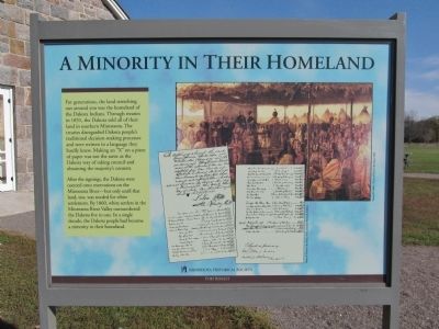
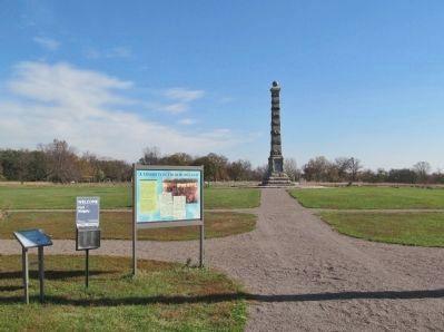
After the signings, the Dakota were coerced onto reservations on the Minnesota River—but only until that land, too, was needed for white settlement. By 1860, white settlers in the Minnesota River Valley outnumbered the Dakota five to one. In a single decade, the Dakota people had become a minority in their homeland.
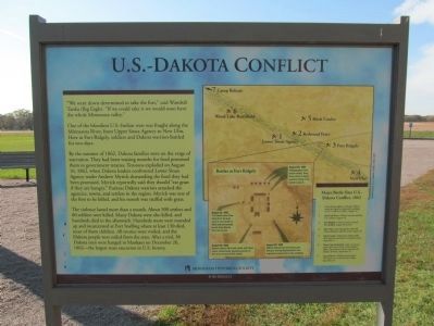
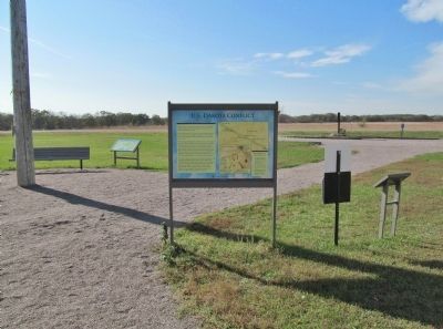
One of the bloodiest U.S.-Indian wars was fought along the Minnesota River, from Upper Sioux Agency to New Ulm. Here at Fort Ridgely, soldiers and Dakota warriors battled for two days.
By the summer of 1862, Dakota families were on the verge of starvation. They had been waiting months for food promised them in government treaties. Tensions exploded on August 16, 1862, when Dakota leaders confronted Lower Sioux Agency trader Andrew Myrick demanding the food they had been promised. Myrick reportedly said they should "eat grass if they are hungry." Furious Dakota warriors attacked the agencies, towns, and settlers in the region. Myrick was one of the first to be killed, and his mouth was stuffed with grass.
The violence lasted more than a month. About 500 settlers and 80 soldiers were killed. Many Dakota were also killed, and hundreds died in the aftermath. Hundreds more were rounded up and incarcerated at Fort Snelling where at least 130 died, most of them children. All treaties were voided, and the Dakota people were exiled from the state. After a trial, 38 Dakota men were hanged in Mankato on December 26, 1862—the largest mass execution in U.S. history.
Fort Ridgely
Erected by the Minnesota Historical Society.
Topics and series. This historical marker is listed in these topic lists: Native Americans • Wars, US Indian. In addition, it is included in the Minnesota Historical Society series list. A significant historical month for this entry is December 1590.
Location. 44° 27.194′ N, 94° 44.094′ W. Marker is near Fairfax,
Minnesota, in Nicollet County. Marker can be reached from County Highway 30, 1.1 miles west of State Highway 4, on the right when traveling west. Monument is in Fort Ridgely State Park; fee area – a Minnesota state park vehicle permit is required. Touch for map. Marker is at or near this postal address: 72404 County State Aid Highway 30, Fairfax MN 55332, United States of America. Touch for directions.
Other nearby markers. At least 8 other markers are within walking distance of this marker. Four Days From Fort Snelling (a few steps from this marker); This Fort Had a Purpose (a few steps from this marker); Economic Engine (a few steps from this marker); Fort Ridgely (a few steps from this marker); Reinforcements Arrive (within shouting distance of this marker); Fort Ridgely Closes (within shouting distance of this marker); Officers' Quarters—C (within shouting distance of this marker); Fort Ridgely State Monument (within shouting distance of this marker). Touch for a list and map of all markers in Fairfax.
More about this marker. captions:
• Treaty of Traverse des Sioux, 1851, courtesy National Archives
• Francis B. Miller, Treaty of Traverse des Sioux, 1904
• David Geister, U.S.-Dakota Conflict, 1862, 2005
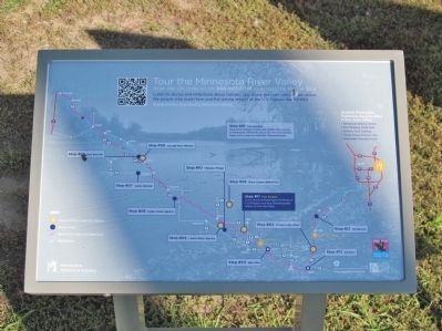
• Major Battle Sites U.S.-Dakota Conflict, 1862
1 Lower Sioux Agency—Hungry Dakota attack the Agency warehouses, sparking the U.S.-Dakota Conflict, August 18
2 Redwood Ferry—Dakota
warriors ambush U.S. soldiers, August 18
3 Fort Ridgely—Dakota warriors attack Fort Ridgely, August 20 and 22
4 New Ulm—Day-long battle ends with Dakota failing to take the town, August 23
5 Birch Coulee—Minnesota militia suffer their heaviest casualties in a surprise attack, September 2
6 Wood Lake Battlefield—After an intense battle with forces led by Colonel Henry Sibley, Taoyateduta and his men flee into Dakota Territory, September 23
7 Camp Release—Dakota release about 259 captives to Colonel Henry Sibley, September 26
• Battles at Fort Ridgely
• August 20, 1862 Pejutazanzan's men launch attack, firing three shots to signal warriors hiding in the ravine to join in.
• August 20, 1862 Dakota attacks from the ravines are delayed, leaving Pejutazanzan's men exposed to cannon fire in the northeast.
• August 22, 1862 Dakota soldiers kill a mail carrier with three shots, inadvertently signaling warriors in the ravine to launch their attack.
• August 22, 1862 The Dakota hear three shots from the east when a mail carrier is killed and prematurely launch their attacks from the ravines.
Also see . . .
1. Minnesota Historical Society. Minnesota River Valley Tour. Fort Ridgely. (Submitted on January 5, 2014.)
2. The U.S. - Dakota War of 1862
. Minnesota Historical Society. (Submitted on January 6, 2014.)
Credits. This page was last revised on June 16, 2016. It was originally submitted on January 5, 2014, by Keith L of Wisconsin Rapids, Wisconsin. This page has been viewed 657 times since then and 19 times this year. Photos: 1, 2, 3, 4, 5. submitted on January 5, 2014, by Keith L of Wisconsin Rapids, Wisconsin.
