Midtown - Downtown in Columbia in Richland County, South Carolina — The American South (South Atlantic)
Gervais Street Bridge
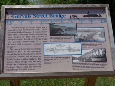
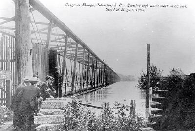
The first bridge at Gervais Street was a covered wooden structure built in 1827 by the Columbia Bridge Company. It remained until 1865 when Confederate soldiers burned it and other bridges to delay the advance of Sherman's troops. Rebuilt in 1870, the bridge was privately owned until 1912 when Richland and Lexington counties bought it.
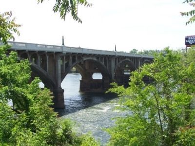
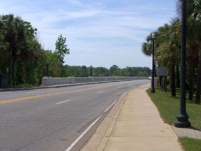
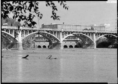
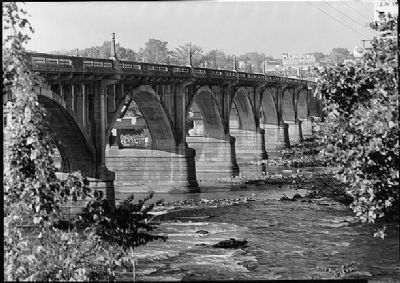
The current 1,415-foot-long bridge opened in 1927. It was considered remarkable for its time due to its use of reinforced concrete and its status as South Carolina's widest roadway. The Gervais Street Bridge was the only bridge in Columbia spanning the Congaree River until the Blossom Street Bridge was built in 1953.
Erected by S.C. State Museum.
Topics. This historical marker is listed in these topic lists: Bridges & Viaducts • War, US Civil • Waterways & Vessels. A significant historical year for this entry is 1827.
Location. 33° 59.813′ N, 81° 2.93′ W. Marker is in Columbia, South Carolina, in Richland County. It is in Midtown - Downtown. Marker can be reached from Gervais Street (U.S. 1/378) near Gist Street. Near a power plant along the Congaree River. Touch for map. Marker is in this post office area: Columbia SC 29201, United States of America. Touch for directions.
Other nearby markers. At least 10 other markers are within walking distance of this marker. 1896 Power Plant (a few steps from this marker); Harnessing Water Power (within shouting distance of this marker); Columbia Canal (within shouting distance of this marker); Congaree River Bridges (within shouting distance of this marker); Doolittle Raiders (about 500 feet away, measured in a direct line); Williams Street / Gist Street (about 600 feet away); Huger Street (approx. 0.2 miles away); Milestones (approx. ¼ mile away); Old Congaree River Bridges (approx. ¼ mile away); Friday’s Ferry (approx. ¼ mile away). Touch for a list and map of all markers in Columbia.
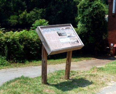
More about this marker. On the right side of the marker are four illustrations. From top to bottom:
1. The 1827 bridge with its wooden covering under construction, after an 1828 sketch by a visiting Englishman. Illustration courtesy of the S.C. State Museum.
2. Confederate soldiers burned this bridge to block General Sherman's advance into Columbia in February, 1865. Courtesy of the South Carolinian Library, USC.
3. Portion of a 1925 site plan map of the proposed (current) bridge. Note the houses that had to be removed. Courtesy of the S.C. Department of Highways and Public Transportation.
4. Horses and carriages can be seen crossing the 1870s bridge. This structure was dismantled when the current bridge was built, and the remains of the older bridge's piers can be seen regularly spaced in the river, just north of the Gervais Street bridge. Courtesy of the South Carolinian Library, USC.
National Register of Historic Places:
Gervais Street Bridge ** (added 1980 - - #80003676)
♦ Spans Congaree River , Columbia
♦ Historic Significance: Event, Architecture/Engineering
♦ Architect, builder, or engineer: Randolph,Charles C.
♦ Architectural Style: Other
♦ Area of Significance: Transportation, Architecture, Engineering
♦ Period of Significance: 1925-1949
♦ Owner: State
♦ Historic Function: Transportation
♦ Historic Sub-function: Road-Related
♦ Current Function: Transportation
♦ Current Sub-function: Road-Related
Also see . . . Gervais Street Bridge. South Carolina Department of Archives and History's page on the bridge. Includes links to the application for National Registry. (Submitted on April 26, 2008, by Craig Swain of Leesburg, Virginia.)
Additional commentary.
1. Gervais Street Bridge
Begun in February 1926 and completed in June 1928, the 1,415 foot reinforced concrete bridge was constructed by Hardaway Contracting Company of Columbus, Georgia. It cost $597,167 to construct. The bridge was designed by Joseph W. Barnwell of Charleston, SC, bridge engineer for the State highway Department.
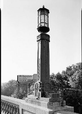
The bridge has a closed spandrel concrete were founded in the rock in the Congaree River, located at the state's "fall line". Thirty-six feet wide, the bridge has four lanes and two cantilevered sidewalls each six feet wide. Above the flanking balustrades are cast iron light fixtures. decorative fixtures have the letter C and a palmetto on the bases, a vine pattern on the eight-side post, and an aecanthus leaf design on the necking.
No alterations have been made to the bridge except for removal and repaving of asphalt.
Significance
One of four open spandrel arch bridges of reinforced concrete in South Carolina, the Gervais Street bridge spans the Congaree River and links Columbia to the western and southern parts of the state. At the time of its construction, this bridge had the widest roadway in the state (two feet wider than the Ashley River bridge in Charleston, SC). From 1928 until 1953, the Gervais Street bridge was the only Columbia Congaree River bridge and is presently the earliest and most decorative of the three bridges across the river.
The site has historically served bridges and ferries. Ferry service was first burned in 1865 to delay Sherman's army. The rebuilt wooden bridge was privately owned until 1912 when it was purchased by Richland County in cooperation with Lexington County. (Source: National Register nomination form.)
— Submitted September 7, 2009, by Brian Scott of Anderson, South Carolina.
Credits. This page was last revised on February 16, 2023. It was originally submitted on April 26, 2008, by Mike Stroud of Bluffton, South Carolina. This page has been viewed 2,376 times since then and 53 times this year. Photos: 1. submitted on April 26, 2008, by Mike Stroud of Bluffton, South Carolina. 2. submitted on September 7, 2009, by Brian Scott of Anderson, South Carolina. 3, 4. submitted on April 26, 2008, by Mike Stroud of Bluffton, South Carolina. 5. submitted on September 7, 2009, by Brian Scott of Anderson, South Carolina. 6, 7, 8. submitted on May 7, 2010, by Mike Stroud of Bluffton, South Carolina. • Craig Swain was the editor who published this page.
